Feeds:
Posts
Comments

The first use of the name Huntington to refer to the town on Long Island was in 1657 when the inhabitants of the town entered into an agreement with Jonas Holdsworth “ffor to Schoole” the children of the town.  The first purchase of land from the native inhabitants had been made four years earlier.  It is unknown for certain how the name Huntington was chosen.

One view holds that the town was named in recognition of the abundance of game that made it a good place for hunting.  Such a descriptive name would be consistent with the naming of the neighboring town to the west which was named for the abundance of oysters in its bay.  If the town is named for its good hunting, why did the settlers use the ancient Anglo-Saxon suffix “ton” meaning town to create the name?  Why not instead call the place Huntingtown?

image

The other view is consistent with the practice throughout New England in the seventeenth century; that is to name the new settlement after a town in England.  Most early New England names have English precedents: Boston, Plymouth, Wethersfield, Cambridge, Southampton, Hempstead, etc.  Under this view, Huntington is named for Huntingdon, a town 75 miles north of London.  It does not seem that any of the early settlers came from Huntingdon, but the name would have been chosen in honor of Oliver Cromwell, who dissolved Parliament three weeks after the First Purchase and was named Lord Protector eight months later.  Were the settlers trying to curry favor with the new head of state?  As Puritans, they would have been sympathetic to Cromwell and would have supported him.

So what about this place Huntingdon?  The suffix “don” has a different meaning than “ton.”  While “ton” means enclosure or town, “don” means hill (see “The Place Names of Huntingdonshire,” by Professor W.W. Skeat published in Proceedings of the Cambridge Antiquarian Society 14 October 1902 to 18 May 1903, No. XLIV). The name Huntingdon was originally Huntandūn meaning “Hunta’s hill.”  Hunta was presumably a person or perhaps just a reference to a hunter, which brings us back to hunting.  It is interesting to note that a 1662 map of Huntingdon spells the name with a “t” instead of a “d.”

1662 map of Huntingdon, note the spelling of the name.

1662 map of Huntingdon, note the spelling of the name.

Huntingdon is the principal town in the old shire or county of Huntingdonshire, which was abolished in 1974 and merged with Cambridgeshire as part of a government reorganization.  Huntingtonshire lives on, however, as a district council within Cambridgeshire.  Huntingdon, the town, has its own governing body.  In this respect, Huntingdon would be equivalent with a village under New York law, Huntingdonshire District would be equivalent to a Town, and Cambridgeshire would be equivalent to a county.  In fact, Huntingdonshire district has a population of about 170,000, similar to the Town of Huntington’s population of 203,000 (Huntingdonshire, however, is much larger at 350 square miles to Huntington’s 94 square miles).

Huntingdon received a charter from King John in 1205, although the settlement in the area extends back to Roman rule in England if not before.  The town is situated on the Roman road from London to York so it became an important market town.  It was a center of Viking activity in the area until King Edward the Elder drove the Vikings out in 921.  The town declined during the Middle Ages and was almost wiped out by the Black Death in 1348.  Where once there had been 16 churches, by the 1530s there were only four.

The seventeenth century Huntingdon Borough Seal.  Showing a hunter and his dogs with a deer.

The seventeenth century Huntingdon Borough Seal. Showing a hunter and his dogs with a deer.

A small Benedictine nunnery, known as Hinchingbrooke Priory, stood northwest of the town.  By 1534, there were only the prioress and three nuns in residence with annual revenues of just £17.  The hospital of St. John the Baptist was established in the center of town in 1160.  Both of these institutions were dissolved as part of Henry VIII’s seizure of Catholic Church properties in the 1530s and 40s.  The old hospital was converted to use as a school.  The Benedictine priory and other more valuable church properties were given to Richard Williams, the nephew of Henry’s chief minister Thomas Cromwell (who is the subject of two bestselling books by Hilary Mantel, Wolf Hall and Bring Up the Bodies).  In gratitude, Williams changed his family name to Cromwell.

The Cromwell family Coat of Arms.  the lion rampant at the top was used in the Town of Huntington's Coat of Arms prepared in for the U.S. Bicentennial.  The town's coat of arms is no longer used in light of its association with Oliver Cromwell, who has been accused of genocide in connection with his actions in Ireland.

The Cromwell family Coat of Arms. the lion rampant at the top was used in the Town of Huntington’s Coat of Arms prepared for the U.S. Bicentennial. The town’s coat of arms is no longer used in light of its association with Oliver Cromwell, who has been accused of genocide in connection with his actions in Ireland.  It should be noted that the lion rampant is a common symbol in medieval heraldry.  

Which brings us to the reason we care about Huntingdon at all.  Oliver Cromwell, a nephew of Richard Cromwell’s grandson, was born in a house at the north end of town in 1599.  When he was 11 years old, he attended the school which had been established in the old Hospital of St. John the Baptist.  As an adult he lived in nearby St. Ives and Ely.  Cromwell was elected to Parliament in 1640.  He later helped raise troops in Huntingdonshire for the Parliamentarians’ New Model Army during the English Civil Wars of the mid-seventeenth century and he defended the area from royalist forces.  Cromwell’s successes were mostly military; he was only a minor figure in Parliament until the Rump Parliament 1650-53.  He dissolved that Parliament on April 20, 1653 and in December of that year was made Lord Protector, a title he held until his death from natural causes in 1658.

The early settlers of Huntington, Long Island, would have supported Cromwell in the Civil Wars.  In naming their new town they could have been honoring his achievements.  As an independent settlement with little direct contact with England, it is less likely they needed to curry favor with the new leader.  Of course, while Cromwell may have been popular with Huntington’s Puritan settlers, his actions in Ireland have rendered him a controversial figure to say the least.

Cromwell was not the only well-known figure from Huntingdon.  His uncle, also named Oliver, spent lavishly and in 1627 had to sell Hinchingbrooke.  He sold the family estate to Sidney Montagu, whose son Edward became the first Earl of Sandwich.  The family dominated the political, social and economic life of the county well into the nineteenth century.

The Fourth Earl of Sandwich

The Fourth Earl of Sandwich

It was the fourth Earl of Sandwich who is credited with placing meat between two pieces of bread so that he could eat without interrupting his gambling; or perhaps it was while he was busy working.  He was also the First Lord of the Admiralty during the War of American Independence and approved Captain James Cook’s round the world voyage.  Cook named the Sandwich Islands (now known as Hawaii) in his honor.

Another notable Huntingdonian was John Major, who served as Prime Minister of the United Kingdom from 1990 to 1997.  His Parliamentary constituency was Huntingdon.

Today, Huntingdon is a quiet community that preserves much of its historic charm.

Huntingdon's pedestrianized High Street.

Huntingdon’s pedestrianized High Street.

All Saints Church in Huntingdon which dates to the Norman period

All Saints Church in Huntingdon which dates to the Norman period

Huntingdon Town Hall built in 1740

Huntingdon Town Hall built in 1745

The Assembly Room in Huntingdon's Town Hall

The Assembly Room in Huntingdon’s Town Hall

The stone bridge between Huntingdon and Godmanchester.  Built in 1332, now open to cars!

The stone bridge between Huntingdon and Godmanchester. Built in 1332, now open to cars!

The sole remaining part of the Hospital of St. John the Baptist, later the school Oliver Cromwell attended in 1610.  Now the home of the Cromwell Museum.

The sole remaining part of the Hospital of St. John the Baptist, later the school Oliver Cromwell attended in 1610. Now the home of the Cromwell Museum.

Facts about Huntingdon

Facts about Huntingdon

Little has been written about the earliest English settlers of Huntington. Although the deed for the First Purchase is dated April 2, 1653, it is believed settlers may have arrived before that date. Initially the population would have been small. In his history of Long Island, Silas Wood states the initial population of the town amounted to eleven families. But a review of the published Town Records reveals that between 1653 and 1663, some seventy names appear in the Huntington Town Records. If each named man were a head of household with an average of five members that would mean a population of a few hundred at even this early time period.

However many there were, all were English. Based on preliminary research it seems the settlers came from a variety of counties in southern England. Most settled first in Massachusetts (especially Salem) and Connecticut before arriving in Huntington. None appear to hail from Huntingdon, the Long Island town’s English namesake. One, however, was born in Huntingdonshire, the small county of which Huntingdon was the principle town.[i]

Robert Seeley was born in  Bluntisham-cum-Earith, Huntingdonshire in 1602. As a teenager he went to London where he joined the cordswainers or shoemakers guild and attended the puritan church of John Davenport. In 1630 he joined John Winthrop on his voyage to Massachusetts as part of the Great Migration. He was one of the first settlers of Watertown, Massachusetts and a few years later was one of the founders of Wethersfield, the first English settlement in Connecticut.

Seeley served as second in command to John Mason during the Pequot War of 1637 and helped lead the attack on a Pequot village at Mystic that resulted in the massacre of hundreds of Pequots. During the war he was shot in the eyebrow with a flat headed arrow. After the war, Seeley joined his minister from London, John Davenport, and merchant Theopilus Eaton when they established the Colony of New Haven. Eaton was the first Governor of the Colony of New Haven.

In 1659, Seeley returned to England for a few years. He came back to the new world in 1662 and that is when we find him in Huntington. In February 1662, at a town meeting in Huntington, it was ordered that the boat should be sent to the mouth of the Connecticut River (presumably Saybrook) to fetch Captain Seeley.

In December 1662, Seeley purchased Eatons Neck from William Jones. The neck was first acquired from the native inhabitants by Theopilus Eaton in 1646. Jones acquired title to the neck by virtue of his marriage to Eaton’s daughter Hannah. The following August, Seeley asked that a confirmation of the deed bearing the marks of five natives, witnessed by two Englishmen, be recorded.

Seeley appears to have quickly become an integral part of the Huntington community. In April 1663 he was nominated as one of three magistrates for the town. The names were sent to the court in Hartford for confirmation. Connecticut records show that the next month he was appointed magistrate as well as the chief military officer for Huntington charged with training soldiers.[ii]  He was also one of the men chosen to review “all lands allredy layd out in filedes and to record the ownar and quantity he has taken up in the town Booke.” The men were also empowered to lay out new fields or home lots at a rate of six pence per acre. Seeley had been assigned similar responsibilities to lay out lots and roads in Watertown Massachusetts in 1634. He also was asked to measure the Huntington Town Common to determine how much fencing was needed to enclose it.

But within a few years, the town sued Seeley over title to Eatons Neck. In all, there were three such suits by the town against the owner of Eatons Neck. It is unclear who the defendants were in the first two cases, but they were found to have good title to the Neck. In 1666, the final suit was heard at the Court of Assizes in New York. The Court found in favor of Seeley, who had already sold the Neck to George Baldwin in July 1663. That sale was confirmed in June 1667 by Richard Nicholls, Governor of the New York Colony.

It is interesting to note that Robert Seeley was one of the eight men named in the Nicholls Patent of October 1666. Those same eight names appear in the Dongan Charter of 1688. By the time of the Nichols Patent, Seeley was no longer in Huntington. In 1665, Seeley helped found the town of Elizabeth, NJ. By the time of the Dongan Charter, 22 years later, he was long dead having died in Manhattan in 1667.[iii]

[i] Huntingdonshire was abolished in the 1970s and the territory it encompassed was made a part of Cambridgeshire.

[ii] The information about Seeley being appointed Huntington’s chief military officer comes from a genealogy website, http://www.seeley-society.net/nathaniel/sgs1.html. I have not consulted the Connecticut records, which is something Charles R. Street, who compiled and annotated the Huntington Town Records in 1880s suggested would be helpful in understanding Huntington’s earliest history.

[iii] Mysteriously, Robert Seeley also appears as a witness on a deed recorded in 1669.  It may be that the deed was made a few years earlier and not recorded until 1669.

We cherish the vibrancy and charm of Huntington village and we are proud of the area’s historic character embodied in various buildings throughout the village. But many feel the village is threatened by fire and redevelopment. The rash of fires (five in the past six months) and proposals for three story buildings in the village may seem alarming, but fire and taller buildings have long been a part of the village scene. In fact, several major fires directly shaped the village of today.

The fire that produced the most dramatic change in the village landscape was in October 1869. To understand its impact, you have to understand the early development of Huntington.

When Huntington was established in the middle of the seventeenth century, the settlement clustered around the Town Common on Park Avenue. The area we now know as downtown Huntington was marshy and sparsely settled. The area was bisected then as now by Main Street which connected Oyster Bay to the west with the area near the Town Common. Only five other streets existed where downtown Huntington is now. On the north side of Main Street were the road to the west side of the harbor (Wall Street), and the road to Lloyd’s Neck (West Neck Road). To the south there was the road to Long Swamp (New York Avenue). Near the Conklin House, New York Avenue forked to the southwest to reach West Hills (now High Street and Oakwood Road). Finally, Woodbury Road led to the settlement of the same name.

Nathaniel Williams’ inn stood on the north side of Main Street, opposite the road to Long Swamp (we now call that road New York Avenue; Long Swamp is the area near the intersection of Depot Road, Maplewood Road and Melville Road). Nathaniel’s son Timothy succeeded his father in running the inn and also operated a store and for a time the post office from the same building. In 1828, Timothy Williams sold the inn to Zophar Oakley, who a few years earlier had purchased property at the northwest corner of Main Street and Wall Street to operate a general store. Oakley’s purchase encompassed 12 acres on the north side of Main Street from Wall Street east to what is now the Trade School property.

Oakley continued to operate the Williams store, which was a true general store offering a wide variety of merchandise—“almost every article called for in the country.” Oakley prospered at his new location and became a very successful and well-respected merchant. In 1845, he built a house northeast of his new store. The property included a spring fed pond, greenhouses, gardens, and orchards. It was considered one of the garden spots of town. At the southwest corner of his property, along Main Street near Wall Street, Oakley rented stores to other merchants. By the 1850s, this row of stores on the north side of Main Street from Wall Street to what is now New York Avenue was known as the Empire Block.

In 1856, Oakley’s son-in-law, Carlos Stuart, and a partner, William A. Conant, took over Oakley’s store and purchased the Empire Block. Less than two years after the sale, Zophar Oakley died. Stuart then gave up his partnership with Conant and transferred his interest in the property to Conant. A year later, Conant, who would later represent Huntington in the State Assembly, sold the property to William Miles of New York City. Miles leased the old store to Baylis & Wells starting in 1862. In 1865, Timothy Baylis purchased the property apparently for his son Hiram Vail Baylis, one of the partners operating the store. Hiram soon gave up the store because of ill health and went into farming. But he held onto the property and rented the store out.

Around this time, at the close of the Civil War, the railroad reached Huntington. Previously, the best route to the city markets was by water. The railroad, of course, was located two miles south of the village. It was thought that a direct road connection between the harbor and the railroad station would be desirable. William Conant by now was the area’s representative in the State Assembly. He introduced a bill to create such a link. The new road would also help to drain the marshy land along the route, but would be expensive to build, which arose opposition from residents who would have to foot the bill. A debate also arose concerning the proper location for the road. The most direct route would extend the existing road through the old general store and continue up to the east side of the harbor where the Town dock was located. An alternate suggested route would start the road east of the terminus of the South Road (as New York Avenue was then known), between the Baylis property and Zophar Oakley’s old property now owned by his daughter Catherine and her husband Carlos Stuart. That route would not be conducive to the smooth flow of traffic.

There the debate stood until October 1869. On the night of October 13, the circus was in town. The old general store was now run by the Mamlok brothers, who closed the store at 8:00 that night. Perhaps they went to the see the circus. When they arrived back at their store at 12:30 a.m., they were surprised by three thieves, who assaulted them, tied them up, stole their cash ($472), and set fire to the store presumably to cover their crime. The brothers managed to escape. But the fire destroyed their store, the adjoining house of landlord Hiram Baylis and the flour and feed store of Pearsall & Conklin to the west. Other buildings on the block were damaged as well.

Baylis began building a new brick house slightly to the east within a couple of weeks. That house still stands on the northeast corner of Main Street and New York Avenue. Conklin also rebuilt his store, but that structure has since been replaced.   The most lasting impact of the fire was that it cleared the way for the extension of New York Avenue to the harbor directly across from the existing road. The State Legislature passed the Road Bill on April 22, 1870. The road was still not popular with the local residents. In June they voted 403 to 0 in opposition to the road. But it was too late; construction was well underway. By July 1870 the road extended from the harbor down to Shoemaker Lane—now known as Mill Lane.

One of the tenants who lost everything in the 1869 fire was lawyer Thomas Young, who had an office on the second floor. Young eventually moved his office across the street to a block of buildings owned by the Brush Brothers. And there, bad luck followed him.

Two decades after the fire that opened the way for the New York Avenue extension, the block on the south side of Main Street east of New York Avenue was occupied by a row of wood frame buildings. On the corner was the general store of Henry S. and James M. Brush. Next was the Bank of Huntington, started by the Brush brothers and Douglass Conklin as a private institution in 1886 and receiving a state charter on July 1, 1888. Then were the stationery store of Edward C. Grumman and the jewelry store of George F. Barr. On the second floor above the stores was the law office of ill-fated lawyer Thomas Young. At the end of the Brush block was the post office and above that the law offices of Charles R. Street, who was the postmaster. To the east of the Brush block were the carriage factory of Ebenezer Jarvis and the harness shop of James B. Scudder and the Second Presbyterian Church.

In the early morning hours of Wednesday, September 12, 1888, an employee of the Brush firm noticed smoke rising from the rear of the post office, which was in the middle of the block. He quickly alerted the Brush family who lived in quarters behind their store. The family barely got out of the house in time and took refuge in Hiram Baylis’ house across the street. The night watchman soon discovered the fire and rushed to retrieve the books and papers from the bank. Soon the alarm at the firehouse on Wall Street was sounded. The paints in the Brush store and the oils in the carriage factory accelerated the fire, which quickly spread both east and west. To the west it stopped at New York Avenue; to the east, it spread as far as the Second Presbyterian Church. Seeing that the church could not be saved, residents worked to save the manse next door by covering the wood roof and sides of the building with wet carpets. They were successful.

The fire destroyed every building along Main Street from New York Avenue to the manse. Fortunately, many of the contents of the buildings were removed before they too were destroyed. In the aftermath of the fire, the Brush brothers built one of the most imposing structures ever erected in Huntington village. Work commenced the month after the fire and by April of the next year, the three-story brick building was ready to receive tenants. As it turned out most of the former tenants returned to the building from temporary quarters throughout the village.

The Brush Block Built 1889

The Brush Block Built 1889

The building still exists, although it has lost its third floor. The third floor on the western one third of the building was removed in 1927, supposedly to make the building more attractive. It may be that the extra space was removed to save on property taxes. The rest of the third floor was removed in 1937 when the Long Island Lighting Company extensively rebuilt that part of the building.

The Brush Block was not the first three-story building in the village. The Leaycraft building at the southwest corner of Main Street and New Street (most well known in recent years as the site of Rubin’s Luggage and torn down in 2004) was a three-story brick building erected in 1859. Other prominent three story buildings include the O.S. Sammis building at the northwest corner of Main Street and New York Avenue (built in 1884); the Masonic Lodge on New York Avenue (built in 1905); Gallagher’s Hotel at 25 Wall Street (built in 1908); and the Romano building at 307 Main Street (built in 1909).

A fire a few years after the Brush Block fire also resulted in a new three-story building. In 1895, the carriage factory on Green Street was completely destroyed. It was replaced by the three-story brick building that still stands at 7 Green Street.

During the building boom of the Roaring Twenties, the three-story Hotel Huntington at the corner of New York Avenue and Fairview Street was built. Two years earlier, another three-story building was built on New York Avenue, the Huntington Office Building. The office building opened on May 1, 1927 “In the center of the growing city.” It featured six stores, a bowling alley and billiard parlor on the first floor; offices on the second and third floors; and the first elevator in town.

The building still stands at 375-377 New York Avenue, but without its third floor thanks to a devastating fire in February 1960. The fire was one of three Monday night fires in a two-month period, raising suspicions that an arsonist was to blame. The fire burned for eight hours through the night as firefighters poured three million gallons of water on it. Like other village fires there was no loss of life; although an attorney working late in his office had to be rescued from the roof of the building by an aerial ladder.

The next day, the west side of New York Avenue was closed in front of the building due to fears that the ruined shell would collapse. The owner was ordered to either make the building safe or demolish it. He indicated he would demolish it. But three months later, he instead applied for a building permit to partially demolish the gutted building to two stories and rebuild. The building we see today is mostly a reconstruction with only two floors instead of three. In 1964, the building welcomed the newly created district court.

The fires of 2014, thankfully, have not been as destructive as some earlier fires. But some, like the March 1 fire at 425 New York Avenue, may result in new three-story buildings. That too would be consistent with Huntington’s earlier building practices (an inspection by the National Board of Underwriters in 1900 revealed that 98% of the buildings in the village were two or three stories high). Whether it will be as welcome as the Brush Block is another question.


I have completed a book on Cold Spring Harbor for Arcadia Publishing’s Images of America series.  The book is available at Book Revue and local stores in Cold Spring Harbor as well as online at http://www.arcadiapublishing.com/9781467122245/Cold-Spring-Harbor.  Below is the introduction to the book.

CSH Book

Water is the defining characteristic of this place now called Cold Spring Harbor.   To the indigenous inhabitants it was known as Wawepex, or “at the good little water place.”   The European settlers of the seventeenth century named the area after its abundance of fresh water springs. The word “harbor” was added in 1826 to avoid confusion with the town of the same name on the Hudson River (throughout the nineteenth century, most locals continued to use the two word name). The name reflects the essential role water, both fresh and salt, has played in the area’s history. The fresh water springs provided drinking water. The stream flowing from the south provided power for local mills. The harbor provided an outlet for trade up and down the eastern seaboard and a starting point for whaling voyages to the far side of the globe.

Even the most disinterested resident knows that Cold Spring Harbor was a whaling port. But Cold Spring Harbor’s whaling period was relatively brief, lasting just over a quarter century from 1836 to 1862. There is far more to Cold Spring Harbor than whaling.

Cold Spring Harbor has been inhabited for thousands of years. Unfortunately, other than some arrowheads, tools made from animal bone, hide scrappers, and pottery shards, little evidence of pre-European settlement survives. For that matter much of the early European settlement is also unknown. The community is a hamlet within the Town of Huntington and was the western edge of Huntington’s First Purchase in 1653.

Within ten years of the First Purchase, at least three permanent homes had been established in Cold Spring Harbor: Jonathan Rogers log house on the east side of what is now Harbor Road about a half mile south of the head of the harbor, the Rudyard house on the north side of Main Street just before the intersection with Goose Hill Road, and the Titus house on the east side of Goose Hill Road across from what is now Titus Lane.

As farms became established, the need for a mill to grind grain was recognized. In order to avoid the need to bring their grain to mills in either Huntington or Oyster Bay to be ground, permission was sought to build a gristmill in Cold Spring Harbor. After two unsuccessful attempts by others, John Adams in 1682 built a dam across the Cold Spring River, an impressive name for the small stream that runs north through the valley from the present site of the rail road station to the harbor. On this dam Adams built both a gristmill and sawmill. The gristmill was not successful; the sawmill was.

In 1700, Benjamin Hawxhurst built a woolen mill near the present site of the Fish Hatchery. Later in the early nineteenth century, the Jones family operated two very successful woolen mills. The upper woolen mill was located upstream on the site of the 1682 mills at the southeast end of St. John’s Pond. This mill was for weaving.   The lower mill was located on the southwest side of the harbor near the entrance to the Cold Spring Harbor Laboratory property. The lower mill was powered by water fed to the site by means of a wooden pipe carried over the road on a trestle from a small pond on the south side of the highway and part way up the hill. The lower mill was used for spinning. Together the two woolen mills produced broadcloth, blankets, and coverlets. Starting in the 1870s, the upper mill was used by George W. Earle as a sawmill and organ factory.

In 1782, Richard Conklin built a paper mill near the intersection of Main Street and Shore Road.

Finally, in 1791, the Hewlett family built a gristmill on the east side of the harbor about a quarter of a mile from the head of the harbor. This mill was powered by water from St. John’s pond that ran through a canal between the road and the harbor. The mill burned down in 1921, but traces of the canal can still be seen today.

Cold Spring Harbor was made a Port of Delivery by an Act of Congress on March 2, 1799. As a Port of Delivery, a Surveyor of Customs was appointed, who had the “power to enroll and license vessels to be employed in the coasting trade and fisheries, and to enter and clear, and grant registers and other usual papers to vessels employed in the whale fisheries.” When Customs Districts were reorganized in 1913, the Cold Spring Harbor office was abolished.

Coastal trading was a thriving activity into the early twentieth century. Small shipyards produced the schooners needed to transport goods not only from Cold Spring Harbor to New York City, but up and down the east coast, to the West Indies and beyond. In the 1840s typical cargo would include rice, sugar, cigars, logwood, mahogany, coffee, palm oil, and ivory. In later years, coal, sand and gravel were typical cargos. An indication of the scope of coastal trading is the fact that in 1883 99 ships were registered from Cold Spring Harbor.

The woolen mills and gristmill were two of the enterprises run by the Jones family. The gristmill came into the Jones family through the marriage of John Jones to Hannah Hewlett. The five sons of John and Elizabeth Jones—especially John H. Jones and Walter Restored Jones—were the leading entrepreneurs in Cold Spring Harbor’s early history. In addition to their mills, they operated a general store near the gristmill, a shipyard on the east side of the harbor, and a barrel factory on the west side of the harbor. The bungs used as stoppers on the barrels gave rise to the name Bungtown. In order to get their various products to market, in 1827, brothers John and Walter R. Jones incorporated the Cold Spring Steam Boat Company, built a dock on the east side of the harbor and later procured the steamboat American Eagle to transport their goods to the New York market.

By the 1830s, foreign competition had undermined the profitability of the woolen business. In 1836, the brothers decided to expand their business ventures to include whaling. At first they personally owned the whaling ships, later they incorporated along with other prominent Cold Spring, Huntington, and Oyster Bay citizens. From 1836 to 1862, nine ships sailed from Cold Spring Harbor on voyages lasting up to two years. Woolens from the local mills, barrels from Bungtown, produce and meat from local farms, and other local products were used to outfit the ships for their months long journeys to as far as Alaska. The venture was successful, but the death of John Hewlett Jones in 1859 and of Walter Restored Jones in 1855 as well as the discovery of petroleum in Pennsylvania in 1859 led to the inevitable demise of Cold Spring Harbor’s small whaling industry.

The economic activity spurred by the whaling ventures was soon replaced by tourism—still a mainstay of the local economy. At the same time, shipyards, a marine salvage yard, sail makers, and blacksmiths continued Cold Spring Harbor’s industrial traditions.

World famous panorama artist John Banvard settled in Cold Spring Harbor in 1852. Banvard made a fortune exhibiting his half mile long painting of the Mississippi River. Audiences would be seated in a specially built auditorium while canvases on either side of the room were advanced from one scroll to another to give the illusion of floating down the river.   After a successful European tour, which included a private viewing for Queen Victoria, he built a castle-like home reportedly inspired by Winsor Castle and named it Glenada in honor of his daughter Ada.

The home was later converted into a luxurious summer resort hotel, which was joined by two others, Forest Lawn next to the Glenada and Laurelton, on the west side of the harbor. Less wealthy visitors could stay at Van Ausdall’s hotel. Day-trippers took steamboats out from New York City by the thousands to visit local picnic groves along the harbor’s shores. Some wealthy New Yorkers built homes of their own overlooking the harbor.

In the decades before the turn of the twentieth century, the old factory buildings on the west side of the harbor were put to new uses. First in 1883, New York State saw the advantages of the area’s fresh water springs to operate a fish hatchery to raise fish to stock local lakes and rivers.  A few years later, the Brooklyn Institute of Arts and Sciences established a field station on the harbor’s western shore.   That small field station has now grown into one of the leading genetics institutions in the world.

Close proximity to New York City, of course, meant that suburbanization was inevitable. The trend began slowly in the 1920s, but was temporarily halted by the Great Depression of the 1930s. It resumed in full force after World War II. This explosive growth not only in Cold Spring Harbor but throughout the Town of Huntington led directly to the establishment of one of the community’s most distinctive assets today—its school system. Originally four separate local school districts, students who wished to continue with high school, attended Huntington High School until 1958. When that district stopped accepting out of district residents, the local districts banded together and built their own high school, now one of the top rated schools in the country.

Tip O’Neill’s observation that all politics is local can also be applied to history.  History is the sum of individual decisions, actions, and experiences.  It is for this reason that it is so important that we record our individual and family histories for the benefit of future generations.

In Huntington, we are lucky that one local woman has done just that.  Helen Tenuto Guarino, whose mother came to Huntington from Italy as a young child at the dawn of the twentieth century, wrote down her family’s history before she passed away in 2010.  Her recollections were intended for her children and grandchildren so that they would know who their ancestors were.  After she died, her daughter assumed the task of finishing the book and realized it might appeal to a wider readership, so she had it professionally printed.

image

The author is seated on the far right.

The 129 page volume touches on the dramatic changes Huntington experienced from the beginning of the twentieth century until the turn of the Millennium.  It is a fascinating transformation seen through the experiences of one family.

It is the story of an immigrant who came to work in one of Huntington’s major industries of the nineteenth century as that industry, brick making, was fading from the scene.  He then farmed land that is now a suburban housing development.  His children served the country in war time and established local companies, which literally helped to build the Huntington of today.

It is the description of farm life in the not too distance past that may be most meaningful.  You may never look at dandelions the same way again.

To order a copy of My Life From Humble Beginnings, by Helen Tenuto Guarino send an email to Anne Marie Guarino at  amtguarino@verizon.net.  The book costs $25.00 plus $5.95 for shipping.

The first war memorial in Huntington, a list of 40 men who had died during the Civil War, contains familiar old Huntington names such as Sammis, Conklin, and Brush.  The second war memorial in Huntington, created in 1923 to commemorate the 39 Huntingtonians who had died during World War I, reflects Huntington’s changing ethnic make up.  In addition to the old Huntington names, the list includes names such as Algerio, Romano, Solomoff, Sickenberger, and Tivola.  More interesting is that the list includes a woman, Janet Ford.

Huntington's World War I Memorial on Main Street.  The Memorial also serves as an entrance to the Old Burying Ground where many of Huntington Revolutionary War veterans are buried.

Huntington’s World War I Memorial on Main Street. The Memorial also serves as an entrance to the Old Burying Ground where many of Huntington’s Revolutionary War veterans are buried.

Janet Ford was a graduate of the Huntington High School class of 1909.  She and her twin sister Eleanor graduated from Smith College four years later.  Not much is known about Janet Ford.  She and her sister were involved with the Huntington Red Cross chapter.  She was prominent enough to be included in a couple of New York Times columns about the social doings in Huntington.  Her father was employed as an expert accountant with Olney & Company in New York City.  He seems to have tried his hand with farming for a while on West Neck Road in the 1890s   The family eventually purchased the house at the southwest corner of Lawrence Hill Road and Carley Avenue.  They continued to spend time in Brooklyn as well.

When the United States entered World War I, there was a need for clerical workers.   The 1916 law authorizing the creation of Naval Reserve Force did not specify that yeomen needed to be men.  Eventually, 11,275 women joined the Naval Reserve Force as yeomen.  Eighteen women from Huntington served in the military; one was Janet Ford who served as a Navy Reserve yeoman in Manhattan.  She died in January 1919—two months after the Armistice was signed but while she was still in the service.  At first the cause of death was reported as pneumonia—the same disease that had taken her father and mother 10 days apart in November and December 1918.  A later report attributed all three deaths to influenza.  The 1918 flu pandemic claimed tens of millions of lives worldwide (estimates range from 3% to 6% of the worldwide population died from the flu).  In the United States, some 500,000 to 675,000 people died.  In fact, ten times more people died in the United States from the flu than from the war.  Half of the American servicemen who died during World War I died from the flu.

Even though she died far from the battlefield and after the Armistice, Janet Ford has always been counted among those Huntingtonians who gave their lives in the War to End All Wars.

Janet Ford is the second name in the second column.

Janet Ford is the second name in the middle column.

The title of this post may be subject to dispute.  After all, 18 Huntington women served in World War I.  Janet Ford is the only one to die during her service.  I hope I can be allowed a little latitude with the claim that she was the first woman veteran.

George Hawxhurst was an elderly blind man who lived at the Industrial Home for the Blind from soon after it first opened in 1951 on the 32½-acre former Walter Jennings estate, Burrwood, in Lloyd Harbor, until he died at the age of 83 in 1976.  He had no known relatives, no money, and was destined to be buried in an unmarked grave in the paupers’ section of a local cemetery.  But the director of the Home and other staff members remembered that he was from an old Cold Spring Harbor family and that the family had a cemetery on the hill south of Cold Spring Harbor’s Main Street.

Neighbors of the cemetery objected.  There hadn’t been a burial in the cemetery in a quarter century, certainly not since the surrounding property had been subdivided and new homes built nearby in the late 1960s.  It would be unsettling for the children who now lived in the neighborhood.  The Town Board, which had control of the cemetery, overrode those objections and agreed that Mr. Hawxhurst should be buried with his family.

Who was his family?  It turns out that Mr. Hawxhurst descended from some of the earliest settlers of Cold Spring Harbor, many of whom, like the cemetery in which they are buried, are now forgotten.

One of the earliest settlers of Cold Spring Harbor was the Rudyard family.  The Rudyard homestead sat at the northwest corner of Main Street and Goose Hill Road and is said to date to the seventeenth century (it survived until 1901-02).  Who the earliest Rudyards in Cold Spring Harbor were has not been determined yet.  But a later member of the family, Captain John Rudyard, married Martha Conklin in 1741 in Huntington.  Their children were baptized in Oyster Bay, which is also where he owned land, so he may have lived there.  Their son John, however, was a carpenter in Cold Spring Harbor.  He married Catherine Doty, from another old Cold Spring Harbor family.

Martha C. Rudyard, one of Captain John Rudyard’s granddaughters, married Walter Jones in 1819.  This Jones, however, is not of the whaling company Jones family.  That family descended from Major Thomas Jones who settled in Oyster Bay by way of Rhode Island.  This Walter Jones was the great grandson of a Jones who came to Cold Spring Harbor directly from Wales.  There was a Thomas Jones who settled in Huntington in the seventeenth century.  A record of his widow conveying land to their children in 1681 can be found in the Huntington Town Records (Vol. 1, page 301).  The progenitor of the whaling family did not arrive on Long Island until 1695.

Martha and Walter Jones had at least six children.  Their son Walter Jackson Jones became a sea captain.  He was not involved in whaling, but with his brother Edmund sailed to Australia, China, and Japan as well as other foreign ports.  He also had oyster beds and provided a barrel of the shellfish to David Bennett Hill, the Governor of New York from 1885 to 1891.

Walter Jackson Jones never married.  He lived with is unmarried sister, Sarah Ann, in the old family house which was located where the Cold Spring Harbor municipal parking now is.  They were considered an eccentric couple.  The house was rundown: chickens would roost on the sills of the open windows.  Sarah Ann died in 1903.  Walter Jackson died in 1916.

A third child of Walter and Martha Jones was Jane who married Edward Seaman.  Edward served in the Civil War and later became a blacksmith in Cold Spring Harbor.  He was one of the founders of the J.C. Walters Post of the Grand Army of the Republic, a fraternal organization for Civil War veterans.  The Seamans lived in a house to the east of the Jones family homestead, where the post office is now located.   Edward Seaman died at age 58 in 1901.  They had one son and three daughters.  One daughter Jennie was born in 1871 and married at age 19.  She appears to have been widowed at a young age.  She and her son George lived with her mother. Jane Seaman died in 1923

Jennie Hawxhurst reported that she was a dressmaker working from home for the 1920 census.  In 1930, she reported housework as her occupation.  In 1940, when she was 69, she reported no occupation.  The next year, it was reported that a real estate developer had purchased the 7½-acre estate of Jane Seaman, including the homestead with plans to subdivide it into half-acre lots.  However, when Jennie Hawxhurst died in 1953, she bequeathed the house to the Industrial Home for the Blind, where her son was then living.  The Home for the Blind owned the property in 1960.  She died at the Hillcrest Nursing Home in Northport.

The Seaman House, now the site of the Cold Spring Harbor Post Office

The Seaman House, now the site of the Cold Spring Harbor Post Office

Eventually, the old Jones homestead property was sold to others and then in 1960 it was taken by the Town of Huntington by eminent domain to build a much needed parking lot for Cold Spring Harbor.  The Seaman home was torn down to build the new post office building in 1962.

All these members of the Rudyard-Jones family are buried high up on the hill behind the family homestead.  An inventory of the cemetery was taken in 1962.  The cemetery was at that time already “in pretty sorry shape.”  Nonetheless, the recorder thought he got all the inscriptions.  He did note that next to Edward Seaman’s grave were two fieldstone markers which were decorated with stones and appeared to be recently added.  He reports, “I have heard tell of an old Mrs. Seaman being buried there recently.”

Fourteen years later, someone remembered well enough to secure George a place in the cemetery—the last of his family to be buried in the old family cemetery behind the long gone family homestead.

This piece was updated on January 20, 2020 based on a newly discovered survey map.

Traveling east from Huntington towards Northport, about a mile past Park Avenue, a driver comes across Old Northport Road.  Until it was changed when the current bank building was constructed a few years ago, the intersection was a true fork in the road.  Continue on Route 25A, which curves to the left and you continue on a major artery passing a nursery, medical offices, and other commercial establishments.   Turn right down Old Northport Road, you travel down a narrow, unlined, quiet, residential street.  Judging by its name, the driver surmises that this was originally the road to Northport, which is, in fact, the case.  It seems obvious that a State highway engineer in Albany decided that this old road to Northport should be by-passed and a new better road built.

But why?  Old Northport Road is perhaps straighter than Route 25A and the descent from west to east is less steep (as is the climb from east to west).  It turns out the situation has nothing to do with Albany bureaucrats and everything to do with an early twentieth century wealthy landowner who wanted some privacy.

But first a detour into the nineteenth century.  Before the twentieth century, there were many fewer roads in Huntington.  Roads were laid out to connect points A and B.  The connection was direct, even if the roads did twist and turn to follow the topography.  Outside of villages, roads were usually nameless.  They were known for the two points on either end of the road.  A look at a road map shows that tradition continues further east, e.g. Patchogue-Mt. Sinai Road, and Miller Place-Yaphank Road.  Closer to home, there’s Syosset-Woodbury Road.  Alternatively, people referred to where the road went, which depended, of course, on which end you start from.  For example, what is now known as Greenlawn Road is known to old time Greenlawn residents as Huntington Road.

A section of the 1858 map of Huntington showing the road between Huntington and Northport, with a turn at the Jarvis house to the road to Centerport's grist mill.

A section of the 1858 map of Huntington showing the road between Huntington and Northport, with a turn at the Jarvis house to the road to Centerport’s grist mill. Click on the map to see an enlargement.

An 1858 map of Huntington shows a road leading from Huntington east to Centerport and then onto Northport (for the most part today’s 25A).  If you wanted to travel to the grist mill in Centerport, which was located on the west side of the harbor at Mill Dam Road, you could turn left at the bottom of the hill east of the intersection with today’s Washington Drive.  Perhaps because this route involved a climb up a steep hill, which was “very dangerous to travel,”[1]  a new road was built branching off of the road to Northport east of the fork with the road to Greenlawn (about where Woodruff Court is today).

It seems the new upper road became the preferred route to the east.  By 1883, the lower road had been so neglected that it was considered unfit for travel even though it “descends through the valley by an easy grade.”[2]  Using the upper road, which was in good condition, presented a problem for those traveling to the head of Centerport Harbor because of the steep slope down to the old road.  A proposal

A section of the 1873 map of Huntington showing the new road to Centerport's grist mill starting near the house of N.B. Conklin.

A section of the 1873 map of Huntington showing the new road to Centerport’s grist mill starting near the house of N.B. Conklin. Click on the map to see an enlargement.

was made to build a new road between the upper road and the all-but-abandoned lower road.  An eleven man jury met on December 15, 1883 at Merrill’s Hotel in Centerport to consider the proposal.[3]  Despite the fact that the new road would be straighter, shorter and less steep, the jury voted seven to four not to pursue the matter.  Opposition focused on the expense of putting in a new road, even though several neighboring property owners promised to contribute funds for the endeavor.  It was thought better to improve the old lower road.

Fast forward to 1907.  Roy A. Rainey, a millionaire sportsman from Cleveland, purchased Carmandale, the horse farm of Richard F. Carman—now the Crescent Club property.  Mr. Rainey quickly set about to improve his new property.    By 1908 hundreds of workers were busy remodeling the house and building a large addition.  The stables, which were too close to the house, were demolished and new stables were built further away.  Tennis courts were added (one grass, one clay).  A sprinkler system installed. A new well was driven.  In short, no expense was spared to create one of the finest estates on Long Island.[4]

There was one problem though.  The road to the Centerport mill ran too close to Mr. Rainey’s new house.  What’s a millionaire to do?  Ask to have the road relocated, of course.  In November 1908, Mr. Rainey asked the Town Board to consent to move the roadway several hundred feet to the south so that it would be the length of three football fields from his house.  On November 23, a special joint meeting of the Town Board and the Town Highway Commissioners met Mr. Rainey’s superintendent to review the proposed changes.  With some minor changes to civil engineer Frank Asbury’s map, the Town Board gave its consent to relocate the road just two days later.  Mr. Rainey, of course, agreed to bear the expense of the change.

The new road ran through the Jarvis farm, which Mr. Rainey purchased, passing between the Jarvis house and barn.

A section of the 1909 map ofHuntington showing the new road built by Roy Rainey.

A section of the 1909 map ofHuntington showing the new road built by Roy Rainey. Click on the map to see an enlargement.

The new route branched off from the road to Northport east of the turn for the road to the Centerport mill.  It then curved gently to the northeast for a short distance, then took an easterly course to the top of the hill where it turned northeast again to connect with the road to the mill.  A connection was built from the new road, down the hill, to meet up with the road to Northport.  We know this today as the intersection of 25A and Washington Drive.

The entrance to Mr. Rainey’s estate was at the southwest corner of his property.  The allee of trees that flanked Mr. Rainey’s driveway still stands and can be seen just west of the medical building at 205 East Main Street.

The new road was naturally the preferred route.  The old road to the south is identified on the 1941 Hagstrom street map as Lower Huntington Northport Road (who wants to take the low road?).  On the official 1946 Town Highway Map, it is identified by its current name, Old Northport Road.

Mr. Rainey’s 1908 road is, of course, now part of New York State Route 25A and has been since the State got involved with roads.  Route 25A never included Old Northport Road.  Historically, road building was a purely local concern.  Town government was responsible for laying out, maintaining and repairing roads.  This patchwork approach proved unsatisfactory by the end of the nineteenth century when bicycling was becoming ever more popular.  Bicyclist—or wheelmen, as they were called—started agitating for better roadways.  Their efforts were finally successful in 1898 when New York enacted the Good Roads Bill, also known as the “League of American Wheelmen Bill.”  Under the new law, the State would assume 50% of the expense of road construction, the County was responsible for 35% and the Town for the remaining 15%.  In addition to improving things for bicyclists, better roads benefitted farmers who could now get their produce to market more easily.

Suffolk County was quickly urged to seek its fair share of State funds.[5]  But it was not until the State raised $50 million through a bond issue in 1905 that large scale funding was available.  An additional $50 million was raised seven years later.

In Huntington State funding helped improve the Town’s two major east west thoroughfares (Jericho Turnpike and the then nameless northern road that is now known as 25A) and two roads to local train stations (Harbor Road connecting Cold Spring Harbor village with its train station, and New York Avenue).  At first dirt roads were improved by spreading gravel.  When gravel proved too difficult to maintain, macadam was used.  Macadam is a construction method rather than a material.  Developed by John Loudon McAdam in 1820, the method called for using small stones, all of the same size over a slightly convex surface.  Starting in the early twentieth century tar was used to coat the stones both to act as a binding agent and to keep dust down.  A surface so treated is tarmac, short for tar-bound macadam.  In the second decade of the twentieth century, concrete was used to form a long lasting durable road surface.  Asphalt was introduced in the 1920s.

What does any of that have to do with Old Northport Road?  When Huntington began to concrete 25A in 1920, the work started in Cold Spring Harbor and went as far as Rainey’s gate.  Later the work was continued from Rainey’s gate to Northport and on to King’s Park.  In other words, the improvements made on 25A were made on Mr. Rainey’s new road, not on the old road to Northport.  Therefore, from the very beginning, Route 25A incorporated the road Mr. Rainey built and not the historic road to Northport.

This explanation may have been as winding as an old country lane.  But I hope we have reached our destination: an understanding of why one segment of what had been the main route between Huntington and Northport is now the road less traveled by.


[1] The Long-Islander, December 21, 1883

[2] The Long-Islander, September 7, 1883

[3] The Long-Islander, December 14, 1883

[4] The Long-Islander, April 24, 1908

[5] The Long-Islander, February 18, 1899

That’s not a greeting often heard even though Congress officially designated September 17 as Constitution Day in 2004.  Before then, September 17 was known as Citizenship Day, the designation given to that date by Congress in 1952.  The holiday’s origins are even earlier.  Citizenship Day had been known as “I am an American Day” and was celebrated on the third Sunday in May pursuant to an act of Congress signed in 1940.

But how and when did “I am an American Day” start?  In a letter to the Editor of Broadcasting magazine (June 28, 1948), Martin Pine claimed his brother, Arthur Pine, gets the credit.  According to Mr. Pine, during the New York World Fair, which took place in 1939-40, songwriters brought his brother a song called “I am an American.”  Arthur Pine, who was handling publicity for bandleader Gray Gordon, convinced the bandleader to use the song on the radio and later Arthur Pine arranged for “I am an American Day” at the World’s Fair.  The celebration was picked up by the Hearst newspapers and came to the attention of President Franklin Roosevelt who signed the legislation officially recognizing the day.

Is that really the beginning of the observation?  Not if you consult a granite monument in front of historic house on New York Avenue in South Huntington.  According to the monument, “I am an American Day” was first held in Huntington in May 1938—a year before the World’s Fair.

1947 Monument

1947 Monument

At that time the home was owned by Mr. & Mrs. Paul Seghers and was known as Sunnyhill Farm.  Mrs. Seghers was from Poland.  Her first husband was a professor of Natural Sciences at the University of Petrograd.  According to a 1957 account, she lost her husband, her only child and her fortune at the hands of the communists before fleeing to America.  To show her appreciation for her new country and its ideals, she decided to devout herself to the propagation of Americanism and an appreciation for the country’s founding documents—the Declaration of Independence and the Constitution.  She established The Helios Foundation, which was dedicated to “cultivating American ideals and better understanding among mankind.”

In Huntington the third Sunday continued to be celebrated as “I am an American Day” despite the change to Citizenship Day made by Congress in 1952.

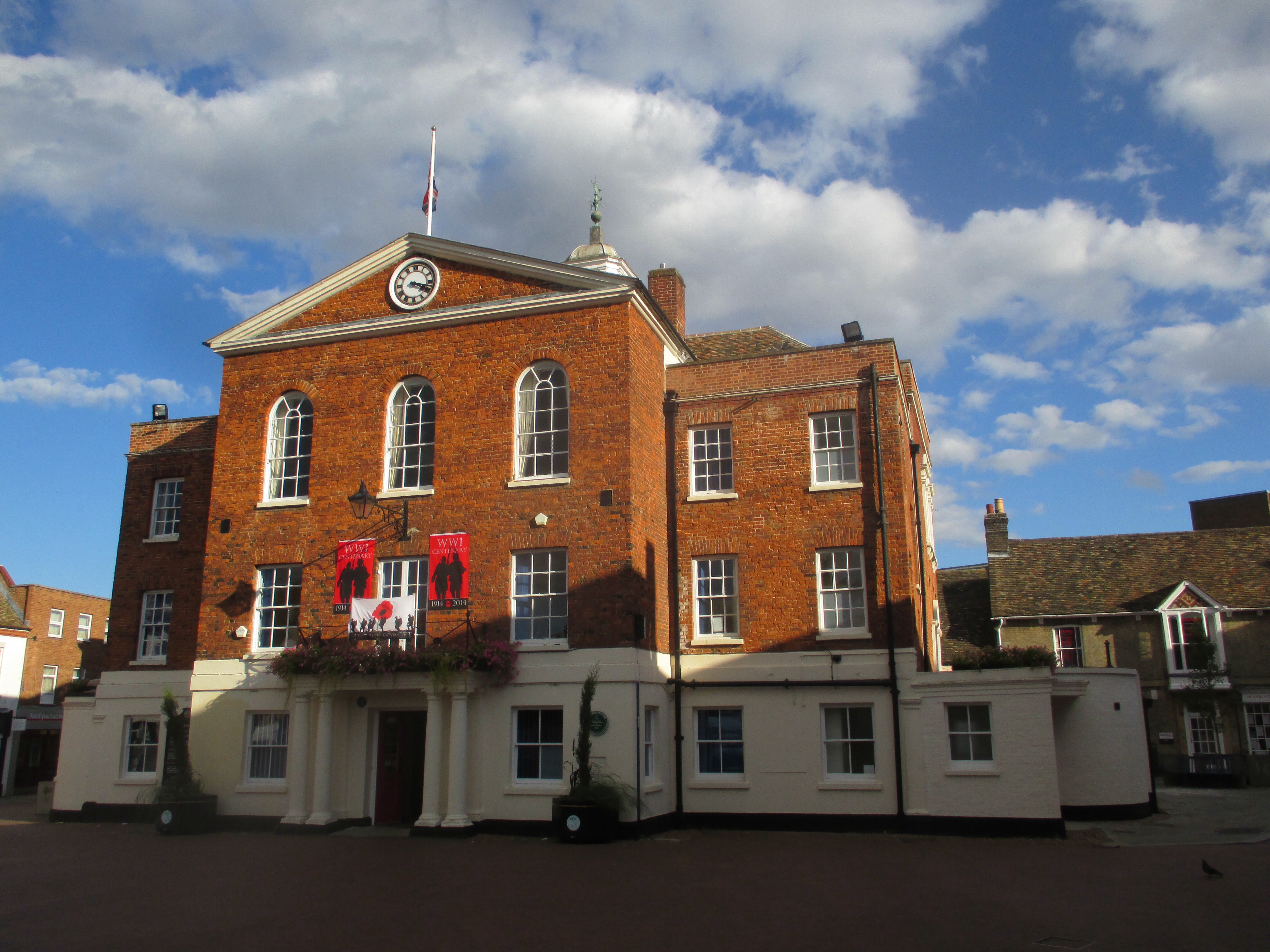
As the Great Depression was just beginning, Florence Baker looked around her town and was disgusted by what she saw:  littered roadsides, ugly billboards, neglected properties.  Perhaps nowhere was the neglect worse than in Huntington’s ancient Green on Park Avenue—worse because it was one place that civic pride would dictate should be well kept.  After all, the few acres of land had been set aside three centuries ago and held in trust for every Huntington resident.  But a place that belonged to everyone seemed to have no one willing to take responsibility for maintaining it.

Florence Baker and some wealthy and influential friends made sure that changed.  Their efforts went far beyond cleaning up a small park at a busy intersection.  They expanded their scope to include the area from the Green to the harbor.  They expanded their vision from cleaning up litter and clearing weeds to preserving open space and historic structures.  Some 75 years later their vision has been adopted—often unknowingly—by other residents as well as town officials.

Baker served as chairwoman of Huntington’s Roadside Committee, an offshoot of the Long Island Chamber of Commerce Roadside Committee.  Formed at the outset of the Great Depression, these committees were dedicated to beautification projects that also served to provide jobs for the unemployed.  In 1931, the Huntington Roadside Committee worked with the Town Highway Department to remove discarded automobiles from the town’s roadsides, clear brush along the town’s streets, and remove illegal signs.[1]

Baker soon turned her attention to the Town Common, better known today as the Village Green.  In 1924, the Green was described as “an unhealthy looking, swampy, mosquito breeding marsh [containing] rotten, broken down trees, masses of rubbish and weeds, and enthroned upon all the hulk of a deceased Ford automobile.”[2]  She was joined by residents such as Marshall Field of Lloyd’s Neck, Raymond Ingersoll of Duck Island, Henry H. Saylor, the Reverend Dr. Edward Humeston of Old First Church, Russell Sammis and most importantly Henry W. Cannon.  Cannon was the president of Chase Manhattan Bank and owned a large tract of land on the east side of Park Avenue across from Sabbath Day Path.  They called themselves the Committee on the Preservation of Old Huntington.  The first order of business was to convince the Town Board to clean up the Green, not only for the sake of civic pride, but also as a way to provide jobs at the depths of the Great Depression.

The Town Common was set aside soon after the Town was first settled in 1653.  Over the years adjoining landowners encroached upon the Green.  The situation became intolerable by the 1730s.  Neighbors demanded that Thomas Wickes, Jr. relinquish parts of the Green that he had occupied.  He did so by a 1739 deed that was worded in such a way as to be misinterpreted to the effect that it appears he created the Green and gave it as a gift to his neighbors.  In fact, he was being paid off to ensure he returned what was not rightfully his in the first place.  This original Green is a rectangular piece of land running along the west side of Park Avenue from the entrance to the Flanagan Community Center (formerly the Village Green School) to a point 329 feet north of Main Street.

Expanding the Village Green

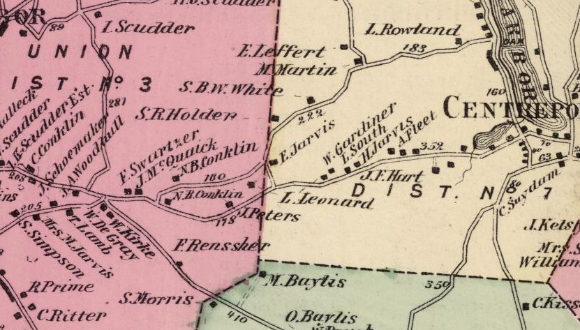
The triangle of land bounded by Main Street, Park Avenue and Sabbath Day Path was at the time mostly privately owned.  The Town Common only included a small triangle at the southeast corner of that plot.  The remaining six acres had been the Mathew Hoban Farm.  Hoban was an Irish immigrant who acquired the land in 1849 from the estate of Thomas C. Hendrickson.[3]  The conveyance was subject to a six foot wide “footway” from “the highway that leads from Huntington Harbour (sic) past the Episcopal Church to Henry Lewis” (i.e. Park Avenue) and ends at the southeast corner of the Presbyterian Meeting House.  Such was the beginning of Sabbath Day Path.[4]

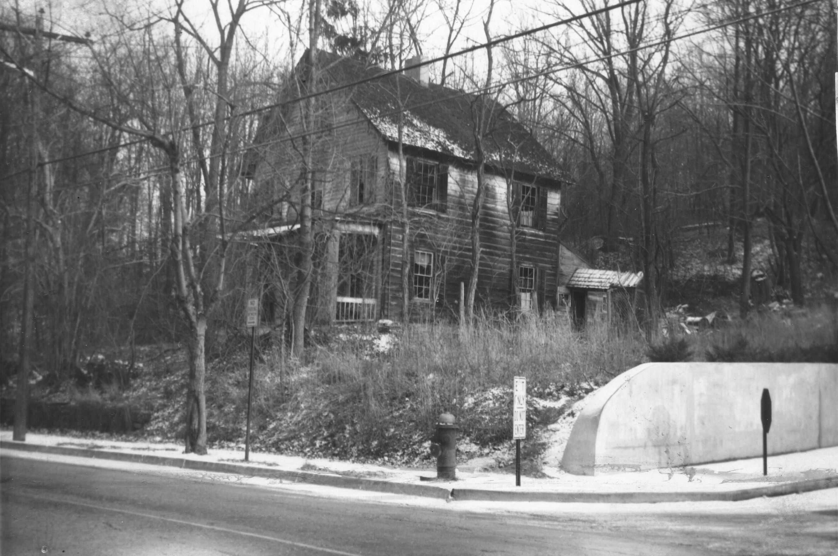
The dwelling on the Hoban Farm—located just north of Main Street—may well have been the town’s original schoolhouse built in 1660.  The first Catholic masses in Huntington reportedly were celebrated at this house.§

At the beginning of the twentieth century the Hoban Farm was acquired by Richard W. Kenney, who the same day transferred ownership to his friend Edward P. Cringle.[5]  Kenney had been living in the old Hoban House as early as 1901 when his friend Cringle and his family visited him.[6]  Cringle was a deputy tax commissioner in New York City.  His son Edward J. Cringle would go on to become a doctor and serve in the army medical corps during World War I.  Edward Cringle, the father, died in 1907.[7]  His widow and son continued to split their time between Manhattan and Huntington.  In 1914, Sarah Cringle had the property subdivided into 25 building lots.  She also tore down the old farmhouse and had “an attractive new home” built.[8]  Mrs. Cringle sold that house to lawyer—later judge—Isaac R. Swezey in 1918.[9]

Dr. Cringle married in 1922.  The following year he began to build houses on Sabbath Day Path, including one for his new family.[10]  Taking advantage of the go-go real estate market of the Roaring Twenties, the doctor formed Edward J. Cringle, Inc., a real estate company.  The directors were the doctor, his wife, and his mother.[11]  Cringle was involved in real estate transactions throughout town, not just on the old Hoban property.  But he soon had financial difficulties.  In 1931, the Bank of Huntington foreclosed on a two-acre tract at the north end of the old Hoban Farm.[12]  The following year, Henry Cannon purchased that tract, which was across from his home, from the Bank of Huntington.[13]  Cannon died just a few months later.  His widow decided to donate that parcel to the town as a memorial to her late husband.  The gift was conditional: it must remain as a park “and never be used as a dumping grounds or for any objectionable purpose.”[14]

Thus began a quest to preserve open space in the heart of Huntington village.  Fifteen years earlier, August Heckscher donated his namesake park to the children of Huntington.  Mrs. Cannon’s donation of what came to be known as the North Meadow was a bridge between the old Town Common and Mr. Heckscher’s park.  In 1935, the Town expressed interest in acquiring land along East Main Street.   The Main Street frontage had been divided into four different lots, one of which contained the house Mrs. Cringle had built in 1914.  A fifth lot was located between these lots and the North Meadow.  The remaining pieces of the Hoban Farm had been divided into eight small lots on Sabbath Day Path, each with a house.

Following Mrs. Cannon’s lead, the members of the Committee on the Preservation of Old Huntington—by now known as Old Huntington Green Association—set out to secure the other plots.  They worked in secret for fear that property owners would inflate their asking prices if they knew a group of wealthy residents was interested in buying their land.

  • In 1938, Clarence Brush, a partner in a local real estate and insurance agency and acting as a straw man, acquired the second lot in from Sabbath Day Path from Frank Patterson.  Ten days later he conveyed it to Old Huntington Green Association.[15]
  • Two years later Brush acquired from Alice Gardiner the lot with the house Mrs. Cringle had built.  Marshall Field provided the $4,500 purchase price.  Six days later Brush conveyed the house lot to Old Huntington Green.[16]  The house was rented to the Reverend Humeston, who had just retired from the pulpit of Old First Church.[17]
  • The back lot was acquired by the Association from William Jenkins in 1941 after the owner failed to pay the property taxes.[18]
  • The final piece was acquired by Mrs. Ingersoll in 1952.  She conveyed it to the Association in 1954.[19]

These four lots were consolidated and the 1.62-acre parcel was deeded to the Town of Huntington in 1957.[20]  Although the Association had been incorporated in 1939, its existence remained unpublicized until the 1950s.  The first newspaper reference to the group was in 1953 and the gift in 1957 was its first public announcement of its work.[21]  Eight years later, the Association built a memorial fountain with the mill stones from Huntington’s first mill.  The fountain was designed by Mrs. Baker and dedicated to the memory of Raymond Ingersoll.  The fountain sits on the property the Association had deeded to the town in 1957.

green

Lots north of Main Street

Now the only property in the triangle not in public hands were the eight houses on Sabbath Day Path and the lot at the corner of Main Street and Sabbath Day Path.  The owner of that last lot, Dr. Frank C. Ciafone, announced plans to erect an office building on the property.  A year after the gift from Old Huntington Green, the Town Board, at the prodding of the Association, voted to acquire the property from Dr. Ciafone for $20,500.[22]

The Association now turned its attention to the eight houses Dr. Cringle had built on Sabbath Day Path.  They were the only interruption on a wide swath of public open space extending from the Town Common through the North Meadow and across to Heckscher Park.  The Association decided to buy and demolish these houses and turn the vacant land over to the Town.  Their first purchase was of the fifth house from Main Street in 1955.[23]  Ten years later, the Association acquired the first and third houses from Main Street.[24]  A fourth house was acquired in the 1970s.

The Association has transferred ownership of two of its Sabbath Day Path houses to the Town of Huntington and they were demolished.  The Town also acquired two other houses that have also been demolished.  Today, four of the original eight houses remain: the Association owns and rents out two; and two others are privately owned.

The Master Plan

Old Huntington Green, Inc. was concerned with more than just preserving open space in the Village Green area.  The group also wanted to preserve historic structures.  First it had to determine which early buildings remained in the valley stretching from the Green to the harbor.   After exhaustive research, 32 buildings were identified.  In 1937, Lester B. Pope, supervisor of the Pratt Institute’s Architectural Department and district officer of the Interior Department’s Historic American Building Survey on Long Island, was asked his opinion of the historic value of Huntington’s old buildings.  He replied that “Old Huntington offers, I believe, one of the most unique historic areas that we have—certainly on Long Island.  It presents an old township which with ease could be restored to its original historic layout and atmosphere.”[25]  Today, of those 32 houses, all but six still stand.  Of those that remain, all but four are now protected by local landmark designation.  The Association’s plan called for preserving these historic structures and moving other historic buildings—such as the Historical Society’s Conklin House—to the Village Green area for protection from unsympathetic development.

Pratt Institute was retained to prepare a map showing the 32 houses.  A photograph album with descriptive captions of each building was assembled.  Old Huntington Green, Inc. hired Armistead Fitzhugh Brinkerhoff, president of the American Society of Landscape Architects, to prepare a master plan for the entire valley.  The Brinkerhoff plan was unveiled in November 1939.  The group was impressed by the scope and beauty of the plan that would be a Long Island version of Colonial Williamsburg, which had been started just 13 years earlier.  Then Marshall Field asked how much it would cost to implement.  Brinkerhoff estimated the total project as envisioned in the plan would cost one million dollars—equivalent to about $16.7 million in 2013.  After giving it a few days thought, Field said he might be able to take on a project with a budget of $50,000 to $75,000.

The grand plan would have to wait.

Influence on Other Developments

While the association continued through the war years, it was dormant from 1948 to 1951.  When it resumed activity, it found a town undergoing explosive growth.  New houses were springing up all over town—even along Park Avenue just south of the Village Green area.  The Green itself was protected, of course.  But surrounding properties were ripe for redevelopment.

The old gas station at the southeast corner of East Main Street and Park Avenue was to be rebuilt.  The Association prevailed upon Mobil Oil to build a “Colonial style” gas station—surely a style for which no historic precedent could be found.  Likewise the newly established YMCA planned to build a multi-story flat roofed building right across Main Street from the association’s property.  The association again convinced the property owner to construct a “colonial style” building instead (although it has been greatly altered by later additions).

A gas station proposed for the northeast corner of East Main and Park Avenue was not built.  Instead a saltbox house designed by Florence Baker’s husband, architect Norman Baker, was built and was used as a real estate office.

A proposal by the American Legion to build a clubhouse on the North Meadow was defeated as were numerous other proposals for the property.  One project the association had a direct hand in was at the northwest corner of Park Avenue and Parkview Terrace.  Mrs. Cannon had purchased the old Platt House at that location and had given it to the association.  The house was in a poor state and structurally suspect.  It was decided that it would cost too much to restore it.  Instead, the property was sold to the newly formed North Shore Medical Group, who agreed to build a “colonial style” medical office, which remains today.  The money from the sale of this property helped to finance the acquisition of lots on the old Hoban Farm.[26]

Continuing Legacy

Old Huntington Green has had an ongoing influence of developments in the Village Green area.   Concerned residents and government officials have pursued plans that track the association’s Master Plan, even though they may not have been aware of the plan’s existence.  The enduring goals set down by the association are slowly being realized.

Many private homeowners in the Village Green area have restored their homes.  The first was the Metcalf family, who in 1941 purchased the Jarvis-Fleet House, part of which is considered to be the oldest house in Huntington.  They began restoration of the house in the 1940s and that work has been continued by their son, Rex Metcalf, who continues to live in the house.  Likewise, other homes along Park Avenue have been restored by their owners.

The Historical Society joined the effort when it purchased the house at 434 Park Avenue in 1967.  Originally identified as the Powell-Jarvis House and thought to date from the seventeenth century, later research and examination has confirmed a construction date of 1795 for Dr. Daniel W. Kissam.

In 1980, the Huntington Town Board created the Old Huntington Green Historic District, which gives legal protection to the historic structures along Park Avenue from its intersection with New York Avenue to a point a few doors south of its intersection with Linda Place.  A few years later a smaller historic district containing properties from View Acre Road to Sunny Pond Farm was listed on the National Register of Historic Places.

The Association’s goals were unknowingly invoked almost 70 years after the group had been founded when another group of concerned residents rallied to prevent the development of eight acres of steeply sloped woodland just off Park Avenue about a half mile south of the Village Green.  Explaining the residents’ concerns, Scott Johnson, then chairman of the Town’s Historic preservation Commission, said, “In the past, there have been those who want to preserve open space and those who want to preserve historical sites, and they’ve never really come together.”[27]  But, of course, they had seven decades earlier.  In November 2001, the group nominated the property for acquisition under Huntington’s new Environmental Open Space and Park Fund program.  The property was to be the beginning of a Heritage Trail that would snake through the open space left on the ridge above Park Avenue, continue to the Village Green and eventually on to the harbor. A year after the nomination, the Town and County purchased the land.  Over the next few years, additional smaller parcels were added.

The biggest obstacle to the completion of the Heritage Trail was the 7.2 acre Park Avenue Dairy site at the corner of Park Avenue and Woodhull Road.  The property not only was mostly open fields and woods, it also contained a wealth of historic structures.  First settled in the seventeenth century, the land had been used for some 266 years to graze cattle.  It also was the site of a tannery; and during the American Revolution, Hessian troops camped there.  The property includes houses from the seventeenth, eighteenth and twentieth centuries as well as a 1915 cement dairy barn and tile silo.  The property was a dairy until 1958.

But the property had been earmarked for other purposes.  In the 1990s, a developer proposed building a 100 bed congregate care facility on the property.  It was later acquired by a group looking to build a synagogue.  When plans for the synagogue fell through, the owner filed a subdivision plan.  Finally late in 2012, the developer agreed to sell five acres to the Town of Huntington.  Two of the historic houses are to be sold to private owners.

The third historic house—the1790 Chichester House—will be moved across Park Avenue to the Sunny Pond Farm property.  Here, owner Tom Hogan will unknowingly implement another part of the Old Huntington green Association’s plan—preservation and repurposing of historic buildings.  Mr. Hogan acquired Sunny Pond Farm after an unsuccessful effort by a different owner to build additional housing on the property.  Mr. Hogan has restored the 1881 house on the property and has already moved the eighteenth century Ketcham house from Fort Salonga.  The Chichester House will be joined with the Ketcham House and both will be converted into office space.  The result will be an office campus comprised of historic houses in an open setting adjoining the Historical Society’s Kissam House property.  Nothing better illustrates the Association’s vision for Huntington’s historic core.

In the end, the fate of one property may well determine how enduring the Old Huntington Green’s goals are.  The “colonial style” gas station on the southeast corner of East Main Street and Park Avenue has been closed for a number of years.  The building has been adopted by a local artist who paints murals of historic scenes.  He recently completed a mural commemorating George Washington’s visit to Huntington in 1790 when the president stopped for lunch at Platt’s Tavern, which once stood on this corner.  The former gas station and the deli next door are inconsistent with the association’s vision.  Over the years plans have been made to rebuild Platt’s Tavern on this site.  There would be no time better than now when the gas station is idle.

But who will take the lead to implement this vision?


  • § Masses were held as early as 1840.  The first St. Patrick’s Church was built in 1849, the same year Hoban acquired the house near the Town Common.  If masses were held here in the 1840s, it would mean that Hoban had been renting the house prior to purchasing it.

[1] The Long-Islander, November 13, 1931

[2] The Long-Islander, July 11, 1924

[3] Suffolk County Clerk’s Office Deed Liber 51, page 217

[4] Huntington Highway Book A 1724-185, page 315 (May 6, 1848, recorded September 18, 1848.  According to Romanah Sammis in Hunting-Babylon Town History, the right of way was first established in 1799 (page 51).  She also reports that Hoban’s petition to discontinue the path in 1858, because it was “no longer necessary,” was granted.

[5] Suffolk County Clerks’ Office Deed Liber 572, page 413 and 414.

[6] The Long-Islander, May 31, 1901

[7] The Long-Islander, June 28, 1907

[8] The Long-Islander, March 20 and 27, 1914

[9] The Long-Islander, June 21, 1918

[10] The Long-Islander, December 1, 1922; May 11, 1923

[11] The Long-Islander, August 7, 1925

[12] The Long-Islander, July 17, 1931

[13] Suffolk County Clerk’s Office Deed Liber 1665, page 200

[14] The Long-Islander, September 7, 1934

[15] Suffolk County Clerk’s Office, Deed Liber 4032, Page 326

[16] Suffolk County Clerk’s Office, Deed Liber 4032, Page 331

[17] The Long-Islander, April 18, 1940

[18] Suffolk County Clerk’s Office, Deed Liber 4032, Page 335

[19] Suffolk County Clerk’s Office, Deed Liber 4032, Page 338

[20] (get deed reference)

[21] The Long-Islander, May 28, 1953 and March 14, 1957

[22] The Long-Islander, October 30, 1958 and November 13, 1958 (Legal Notice).

[23] Suffolk County Clerk’s Office, Deed Liber 3936, page 197

[24] Suffolk County Clerk’s Office, Deed Liber 5762, page 497; and Deed Liber 5834, page 176

[25] Unpublished manuscript history of Old Huntington Green, Inc.  on file in the Huntington Town Historian’s office and at the Huntington Historical Society.

[26] The Long-Islander, March 12, 1953

[27] Newsday, November 3, 2002, “History Trail Nearly Reality”