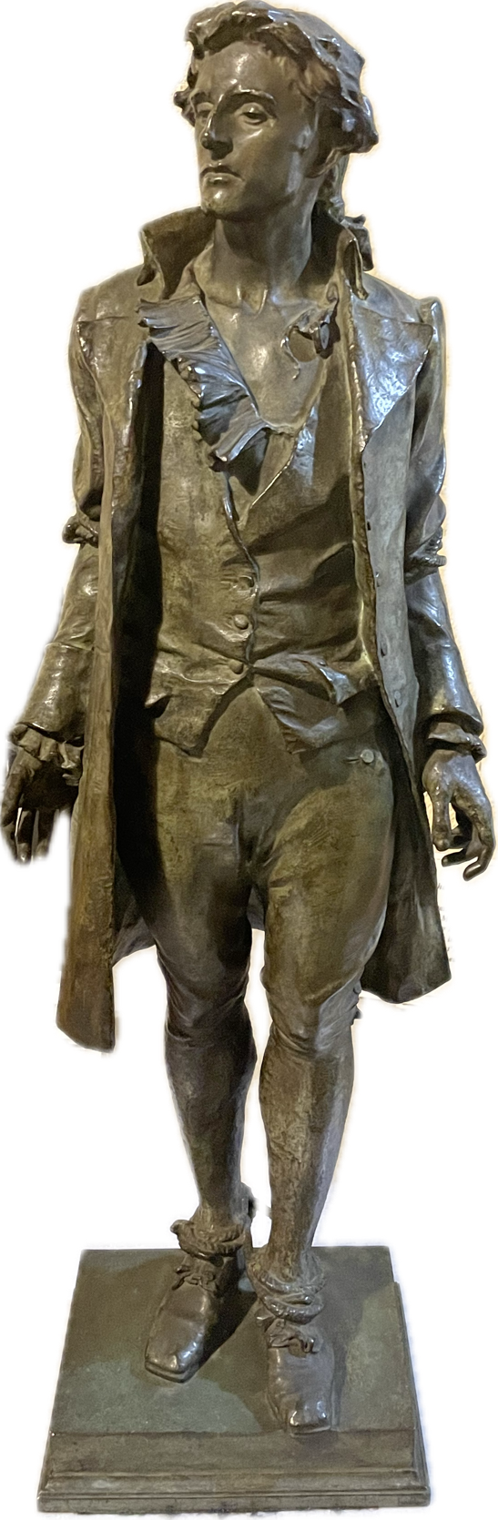
Nathan Hale can be considered many things: a hero, a martyr, a failed spy. But mostly Nathan Hale is a mystery.
We know a fair amount of Hale other than the last two weeks of his life. He was born in Coventry, Connecticut in 1755. He graduated from Yale College in 1773 and then became a schoolteacher in Connecticut. After the Battle of Lexington and Concord in April 1775, he joined the Connecticut Militia and was soon elected lieutenant. He was at the siege of Boston.
The British left Boston on March 17, 1776 and Hale followed George Washington to New York, the anticipated next scene of conflict with British forces. That conflict came a few months later with the largest battle of the war. The American forces lost the Battle of Long Island but miraculously escaped to Manhattan. After the defeat, George Washington needed intelligence about British activities on Long Island and their plans to attack Manhattan.
As early as September 1, he asked his generals to find someone to gather intelligence of British activities on Long Island. He urged them “to establish ‘a channel of information’ through which frequent reports from the Long Island side could reach him.”
“Perhaps,” he wrote, “some might be got who are really Tories for a reasonable reward to undertake it. Those who are friends would be preferable, if they could manage it as well.”[1]
At the same time, Washington organized a Rangers unit under the command of Thomas Knowlton, who was tasked to recruit men to conduct tactical reconnaissance for the army.[2] Hale was recruited as a captain of one of the four companies in the unit.
Although the exact date is not known, sometime in the second week of September, Hale answered Washington’s call to gather intelligence on the British. What transpired over the next two weeks is a mystery. Much has been written over the past 250 years concerning Hale, much of it is speculation for there is scant direct contemporaneous evidence on which to rely.
His friends thought Hale was too naïve to be a good spy and tried to talk him out of proceeding. “From an intelligence perspective, he was a lousy spy. His selection, training (or lack thereof), and how he conducted his mission were horrible by both intelligence and commonsense standards.”[3]
The man who accompanied him from New York to start his journey provides details about the beginning of the mission. Sargent Stephen Hempstead shared these details in 1827 when he was 69 years old. He had served in Hale’s company of the Connecticut Militia. According to Hempstead, Hale told him that he was asked “to go over to L.I. to discover the disposition of the Enemy’s camp, &c., expecting them to attack N.Y.”[4] Sharing such details was not an auspicious start for a secret spying mission.
Hempstead says they left the American camp in Harlem Heights and made their way to Norwalk, which was the first place they could find a ship to ferry Hale across the Sound to Long Island. Hale left his belongings with Hempstead, except for his Yale diploma, and said he would pretend to be a Dutch school teacher looking for a position. It doesn’t make sense that he would pretend to be Dutch, especially since he would be travelling through the west end of Long Island, which still had a sizeable Dutch population. I.W. Stuart, who wrote an account of Nathan Hale’s mission in 1856, suggests that Hale was joking when he said he would be a Dutch schoolteacher. How would he explain that he had the diploma of a man with a very English name? But if he were a Connecticut schoolteacher looking for a school, carrying his Yale diploma as proof of his qualifications makes sense.
Captain Pond took Hale and Hempstead across the Sound on the Schuyler. They landed at Huntington Bay. That was the last time Hempstead saw Hale. Hempstead returned to Norwalk to await Hale’s return or word from Hale. (Alexander Rose, without citing a source, writes that a Tory informant in Norwalk noticed “the arrival of two men, both army types, only one of whom departed quietly in the night with the sloop while the other, Sergeant Hempstead, headed westwards back toward American lines.”[5] This is inconsistent with Hempstead’s first-hand account.)
According to Ida Johnson, writing in 1894, once on shore in Huntington, the first man Hale met was her great grandfather William Johnson, who lived in a house that still stands at 124 Bay Road. Johnson gave Hale some food and then Hale set off, telling Johnson that he “should watch for him on his return.”[6]
What Hale then did, where he went, what he discovered are unknown. We do know that he was captured a few days later and that at 11:00 on the morning on Sunday, September 22, Hale was hanged in Manhattan, near Third Avenue and 66th Street.
Where and how he was captured have been in dispute for the past two centuries.
According to the version widely believed in Huntington and set forth by Charles R. Street in his annotation of the Huntington Town Records (1889), Hale
made his way to Brooklyn, and having acquired the information desired, returned to Huntington; remained over night at the home of a friend, William Johnson, on East Neck. The next day he ventured down to a public inn kept by “Mother Chid,” (Chichester) at a place called “The Cedars,” at the head of Huntington Bay, near where Titus Conklin now lives, intending to cross to Connecticut in a boat. Seeing a boat approach he took it for the one expected, but he was mistaken, as it came from a British vessel and was manned by British sailors. His true character was revealed by a Loyalist at the inn and he was taken prisoner, hastened to the City of New York, and hung as a spy.[7]
British Troops had arrived in Huntington two weeks before Hale. So as soon as he arrived, he was in enemy territory.
But this “official” version began to be questioned. In 1918, Augustine Scudder, principal of the Lincoln School in Huntington Station, read a paper to the Huntington Historical Society arguing that Hale was not captured in Huntington. She relied on Henry Phelps Johnston’s 1914 biography of Hale. Johnston argued that Hale could not have been captured in Huntington because British General Howe’s Orderly Book for September 22 states “A spy from the enemy (by his own full confession) apprehended last night, was this day executed at 11 o’clock in front of the Artillery Park.” Johnston points out that if Hale was “apprehended” the night of September 21, there would not have been enough time to bring him from Huntington to Manhattan the same night, which was presumed to have been done by the H.M.S. Halifax, a 16-gun British warship. Moreover, Johnston asserts that the log for the Halifax indicated that the ship was not in Huntington at the time and that the log “in which every incident appears to be noticed, makes no mention of anything so creditable to her crew as the capture of a spy.”[8]
Romanah Sammis, president of the Historical Society and later Town Historian, agreed that Hale was not captured here.[9] Scudder and Sammis argued that Hale would have followed the British army into Manhattan after they landed there on September 15. Then being only a mile or so from the American forces in Harlem, it would have made no sense for him to return to Huntington. By the time he walked back to Huntington, was ferried by boat to Connecticut and walked back to the American camp in Harlem, it would be too late for his intelligence to have been of any use to Washington. Indeed, one could argue the whole enterprise, even if successful, was too lengthy to have been of much use by the time he would have returned to camp. Then again, the siege of Boston began on April 19, 1775 and the British did not attack the American forces until June 17, when they successfully captured Bunker Hill, but at the cost of a thousand casualties.
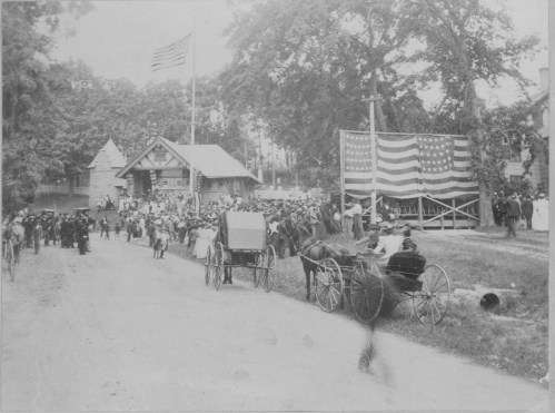
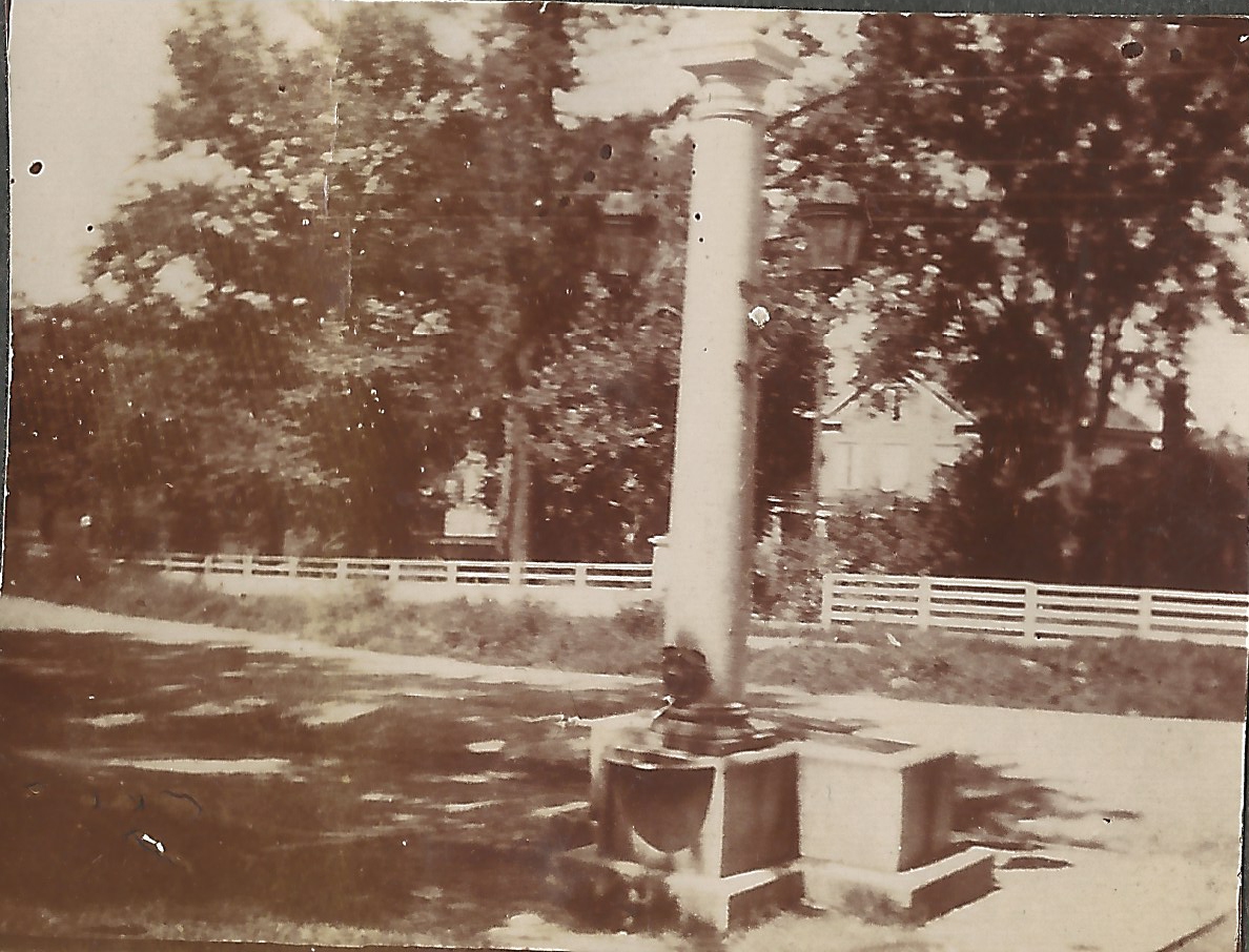
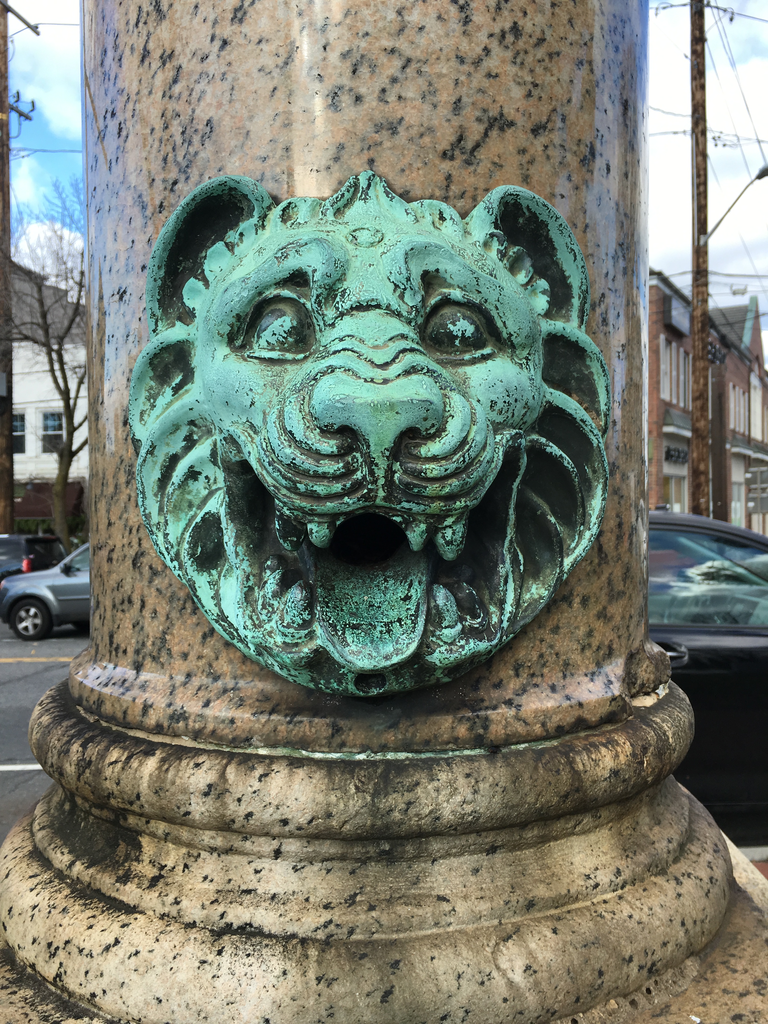
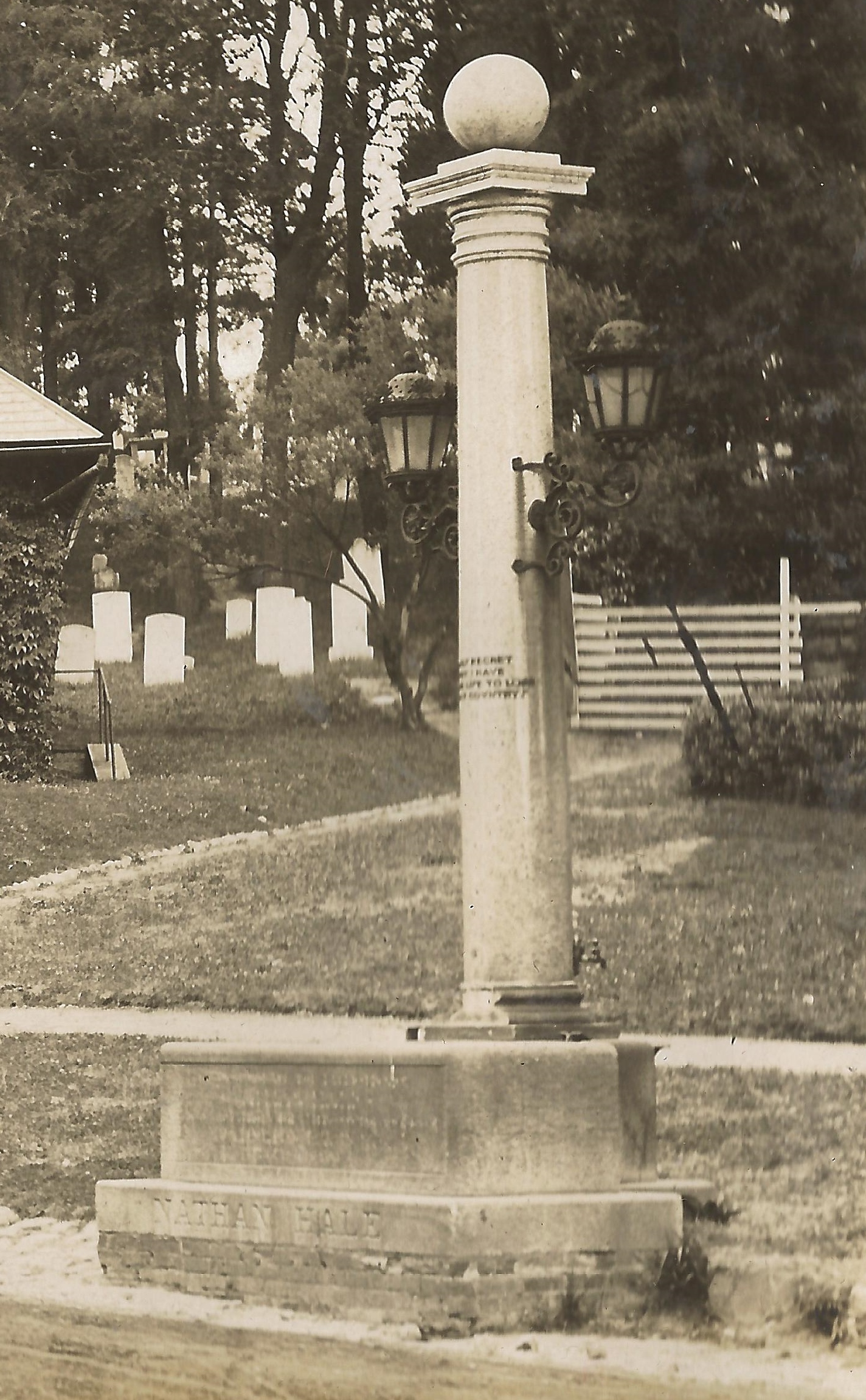
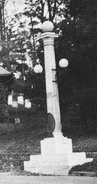
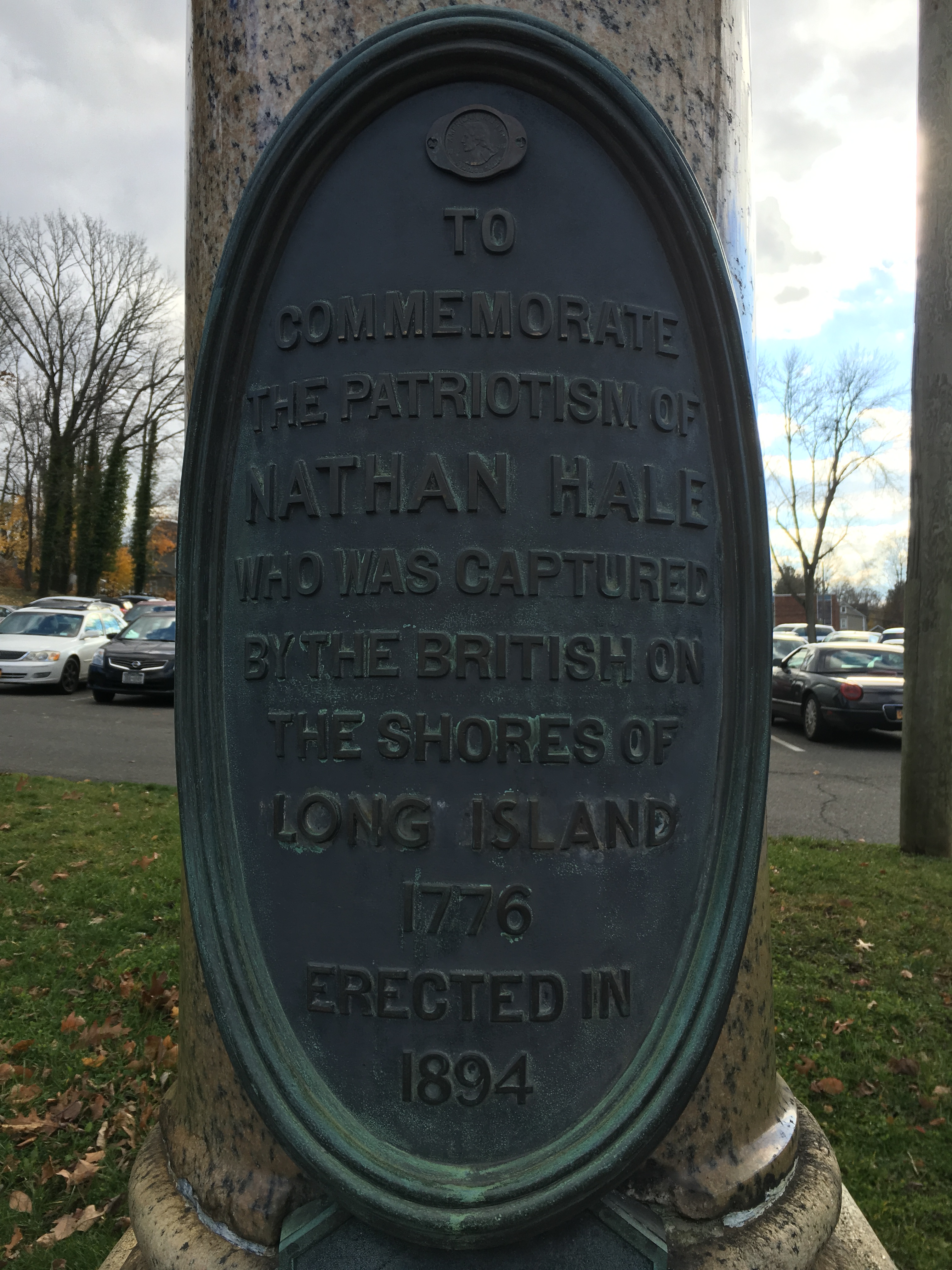
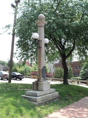
Sammis continued to argue that Hale was not captured in Huntington, suggesting in 1927 that the Nathan Hale memorial on Main Street should be removed.[10] She said the memorial was “a ‘miserably unsightly thing’ that was given to Huntington because it was left over on some job.”[11]
Sammis convinced the Town Board in 1935 to appoint a committee to study the matter.[12] The committee was greatly assisted by the work of Town Counsel Isaac Swezey and Walter Funnell, who had been appointed to the committee but resigned because he was living in Westchester at the time. While the committee released its report in 1939, Swezey and Funnell continued their research and corresponded with each other about this matter until their deaths in the 1950s.
The question of where Hale was captured depends on how he was captured. If he was captured because he mistook a British boat for an American boat, his place of capture must have been in Huntington because that is where he was expecting there to be a ship to take him back to Connecticut.
However, another version of Hale’s capture credits Robert Rogers of the Queen’s American Rangers with capturing Hale. Rogers was a hero of the French and Indian War who was commissioned by British commander William Howe to recruit a battalion of Loyalists. After the Battle of Long Island, Rogers’ Rangers were deployed to the north shore of Long Island to recruit members.[13] The Huntington committee discovered a diary kept by Captain William Bamford, a soldier in the British army. The diary did not come to light until 1933. Bamford’s entry for September 22, 1776 reads “Nathan Hales, a Capt in ye Rebel Army & a spy was taken by Majr Rogers & this mg hang’d he had several Papers wt accts of our Forces &ca he confess’d many deserters come in. he was a spy.”[14]
The reference to Rogers as Hale’s captor led the committee to review of the logs of the Halifax. The logs show that Rogers and his Rangers were aboard the ship in the period from September 16 to 21, the same period Hale was conducting his mission.
After reviewing the evidence at their disposal, the committee concluded that “it is manifestly impossible to prove absolutely that Nathan was captured at Huntington.” However, from the facts uncovered by the committee “the probability of capture at Huntington would appear to be much increased.” Therefore, with respect to changing the wording on local monuments, “it is the opinion of the Committee that the memorials were erected in good faith, that the tradition they embody is now strongly supported, and that it is not needful to disturb those memorials at present.”[15]
The most prominent biographer of Robert Rogers, writing in 1959, mentions the capture of Nathan Hale only briefly, relying on Bamford’s diary to connect Rogers to the capture. He posits that “Rogers’ connection with the incident is merely that he was halted while en route to Howe’s headquarters in his sloop and asked to bring Hale in.”[16] But an eighteenth-century manuscript that first came to light in 2000 when it was donated to the Library of Congress describes a much larger role for Rogers. Consider Tiffany was a Connecticut merchant who remained loyal to the crown. He wrote an account of the Revolution, either during or shortly after the war. According to Tiffany’s account, Hale was sent to Long Island “to find whether the Long Island inhabitants were friends to America or not.” This is a different mission than that described by Hale’s companion, Sargent Hempstead, who said Hale was sent to Long Island, “to discover the disposition of the Enemy’s camp, &c., expecting them to attack N.Y.” Likewise, Benjamin Talmadge, Hale’s Yale classmate and friend, recounting his interaction with Major John Andre after the British officer was captured, wrote that “After the British troops had entered N. York, Genl Washington wanted information respecting the strength, position & probable movements of the Enemy. Capt. Hale tendered his services, went into N. York, & was taken just as he was passing the out posts of the Enemy.”[17]
Beyond the difference in the description of Hale’s mission, Tiffany gives a completely new account of the circumstances of Hale’s capture and with a level of detail that seems unlikely for a shopkeeper in Connecticut to have known:
Colonel Rogers having for some days observed Capt. Hale, having for some [days] suspected that he was an enemy in disguise. And to convince himself, Rogers thought of trying the same method. He quickly altered his own habit with which he made Capt. Hale a visit at his quarters where the colonel fell into some discourse concerning the war, intimating the trouble of his mind in his being detained on an island where the inhabitants sided with Britons against the American colonies. Intimating withal that he himself was upon the business of spying out the inclination of the people and [the] motion of the British troops. This intrigue, not being suspected by the Capt. made him believe he had found a good friend and one that could be trusted with a secrecy of the business he was engaged in. And after the colonel’s drinking a health to the Congress informs Rogers of the business and intent.
The colonel, finding out the truth of the matter, invited Capt. Hale to dine with him the next day at his quarters unto which he agreed. The time being come, Capt. Hale repaired to the place agreed on where he met his pretended friend with three or four men of the same stamp and, after being refreshed, began the same conversation as hath been already mentioned. But in the height of their conversation, a company of soldiers surrounded the house and by orders from the commander seized Capt. Hale, in an instant. But he, denying his name and the business he came upon, was ordered to New York. But before he was carried far, several persons knew him and called him by name. Upon this, he was hanged as a spy, some say, without being brought before a court-martial.[18]
It is interesting to note that based on this account, two later writers differ on which meal Hale and Rogers shared when they met for the second time. Kenneth Daigler writes that they met for breakfast;[19] whereas Alexander Rose writes that they met in the afternoon and Rogers ordered ales for the group.[20]
One would hope that a review of the ship’s log for the Halifax would help to settle the question. But the log is difficult to decipher due to the handwriting, the use of abbreviations, and a lack of punctuation. Confusion may also have been caused by readers not appreciating that the log was recorded using a nautical day—that is a day that starts at noon the day before the date given. In other words, an entry for September 17 would start at noon on September 16 and end at noon on the 17th.
The Halifax log records that on the night of September 16, the Halifax “rec’d by sloop Conl. Rogers and a Party of Rangers.” At 4:00 a.m. on the 17th, the ship was in Huntington Bay to look for “two Rebel Privateers having Intelligence of them.” This most probably refers to the Schuyler, which is believed to have dropped Hale off early on the 16th. The second ship is believed to be the Montgomery, whose captain, William Rogers, was from Huntington. The search was unsuccessful.
On the 18th, a tender from the Halifax captured a Patriot schooner that was transporting four cases of gunpowder. The powder was taken and the schooner sunk. That same day there is a reference to “Sanseys point.” The evening of the 18th, the Halifax was off Oyster Bay near Centre Island. At 3:00 on the afternoon of the 19th, the ship was near Hempstead Bay. Later that night, “the Party of Rangers landed on Sanseys p.” This has been interpreted over the years as referring to Sands Point, located on the west side of Hempstead Bay and 16 miles west of Huntington Bay. However, historian Claire Bellerjeau discovered that the peninsula that Huntington residents think of as Wincoma Point is officially known as Sandy Point. That is the name given on the 1946 Official Highway map for the Town of Huntington and on the Town’s Geographic Information System map and in eighteenth century Huntington Town Records.[21] The peninsula is also called Sandy Point in newspaper articles and reports of the Chief of Engineers, U.S. Army.
The Huntington location is also supported by the account given by Stephen Hempstead, who had accompanied Hale at the start of his mission. Hempstead thought Hale was captured in Manhattan “at a tavern at a place called the ‘Cedars.’” But as noted by Seymour in his book, “There is no such geographic point revealed in all the exhaustive research which has been devoted to the famous island.”[22] But the shores of Huntington Bay, where Mother Chick’s Tavern was located, was known as the Cedars.[23] As with many of the accounts of Hale’s mission, Hempstead may have mixed up some details.
But the Halifax was off Hempstead Bay at 3:00 p.m. on the 19th. Could it have sailed east to Huntington Bay to drop off the Rangers? Wherever the ship was at 10:00 that night it weighed anchor and arrived at Whitestone Point at 4:00 a.m., six hours later. Whitestone Point is about 8 miles from Sands Point and about 26 miles from Huntington Bay. An 8 miles sail should not take six hours, but a 26 miles sail could.
At Whitestone Point, the Halifax was in company with the Niger, a British ship that spent the month of September at Whitestone. The log for the Niger reports that at 7:00 p.m. on the 19th it was “hailed from the North Shore.” A boat was sent and “returned with a Rebel Officer, a Deserter from their Army.” On the morning of the 20th, the Niger’s log records that the Halifax was anchored nearby, having come from the eastward. The next words in the Niger’s log are “Sent the Rebel officer to Head Quarters.” Could this have been Nathan Hale? It seems unlikely because this Rebel officer was taken to the Niger on the night of the 19th from the “North Shore,” which may refer to the north shore of the Sound, not the north shore of the Island. In any event, the Halifax log reports that on the 22nd—the day Hale was hanged—“Col. Rogers and his party of Rangers came from Flushing.”
The timeline above does not leave enough time to support Tiffany’s account.
As mentioned above, Swezey and Funnell continued their research long after the Huntington committee issued its report in 1939. After their deaths in the 1950s, their research papers were donated to the Huntington Historical Society, where they apparently sat unread for the next 70 years. But with the 250th anniversary of Hale’s execution in 2026, Toby Kissam read through the files and realized a theory supporting Huntington as the place of Hale’s capture could be developed.
Swezey secured letters from descendants of William Ludlam of Centre Island and William Johnson of Huntington Bay as well as a secondhand account from a woman whose ancestors had lived in the house in Newtown (now Elmhurst) that Howe had used as his headquarter for the first two weeks of September.
According to these testimonies, William Johnson helped Hale at the start of his mission. How would Hale have known to trust Johnson? Perhaps he was advised by William Rogers, the captain of the second privateer that accompanied the Schuyler, that he should look for Johnson’s house after he landed on the beach. Johnson’s descendants claim that their ancestor ferried Hale across Huntington Bay, through Lloyd Harbor and over the beach to Cold Spring Harbor then over to Centre Island. There Hale was able to borrow a horse from William Ludlam. Hale then set off on his mission—wherever that would have taken him. Swezey secured a letter from a Ludlam descendant to report that Hale returned the horse a few days later and returned to Huntington Bay to wait for the Schuyler to retrieve him.
In his book on the Culper Spy Ring, Alexander Rose contends that Rogers, “guessing that Hale would head west along the coastal road toward the city, planned to lie in wait to intercept him.”[24] But Rogers isn’t the only one guessing; Rose is also guessing. There appears to be no primary source for the proposition that Rogers followed Hale as he traveled west of the “coastal road” (presumably North Hempstead Turnpike, Route 25A). If Hale’s destination was Brooklyn, a better, less hilly route would have been by way of what is now Jericho Turnpike. It is perhaps more likely that Rogers guessed that Hale would return to the place he had started his mission, Huntington Bay. Therefore, Rogers could have decided to land at Sandy Point, Huntington and wait for Hale to return.
Whether one credits Tiffany’s account of Rogers trickery or the mistaken boat version, Hale would have been taken to Manhattan to be hanged. A likely route would have been by water to Flushing Bay, which is near Newtown, where Howe had had his headquarters until September 15. Swezey was told by a woman who lived to the house that was formerly Howe’s headquarters that she had been told by an 85-year-old woman, whose parents or grandparents had previously owned the house that Hale was kept in the basement of the house. Then on the 21st, he could have been transported over to Newtown Creek and from there taken by boat down the creek and across the East River to Howe’s new headquarters in Manhattan, where he was summarily sentenced to death. Rogers and his Rangers then returned to the Halifax by way of Flushing on the 22nd.
The truth may never be known with certainty but, as pointed out by the 1935 committee, Huntington appears to be the only locality with a tradition as being the place of Hale’s capture. Huntington as the place of capture is also supported by testimony from Robert Townsend and other Oyster Bay residents.[25]
Famous Last Words
The reason Hale is remembered is not because he was a valuable spy, but because of the final words attributed to him: “I only regret that I have but one life to lose for my country.”
In recent years, it has become popular to note that there is no proof that Hale ever said those words. That is true, but the legend persists. The famous last words are probably the work of Hale’s friend Captain William Hull and were most likely inspired by a line in a 1712 play by Joseph Addison called Cato, A Tragedy. In Act 4, Scene 4, Cato says, of the death of his son, “How beautiful is death when earned by virtue. Who would not be that youth? What pity is it that we can die but once to serve our country.”
Whether the line inspired Hale or Hull is the question. The first report of Hale’s last words appeared in the Essex Journal (Massachusetts) of February 13, 1777, which states that: “At the gallows, he [Hale] made a sensible and spirited speech; among other things, told them they were shedding the blood of the innocent, and that if he had ten thousand lives, he would lay them all down, if called to it, in defence of his injured, bleeding Country.”
Four years later, the Boston Independent Chronicle reported that Hale’s last words were “I am so satisfied with the cause in which I have engaged, that my only regret is, that I have not more lives than one to offer in its service.” By 1799 in Hannah Adams’ Summary History of New England, the statement came closer to the famous version, “he only lamented, that he had but one life to lose for his country.” [26]
* * *
Marker Mix-up
Confusion about whether Nathan Hale was captured at Mother Chick’s in Huntington or elsewhere extends to where exactly Mother Chick’s was.
In 1977, during the celebration of the Bicentennial, a historic marker was placed on Bay Road just south of Dale Road. The marker identifies this as the location of Mother Chick’s Inn. Unfortunately, the marker was in the wrong place. In 1776, the house at that location, which still stands, was the home of William Johnson, not Mother Chick. Mother Chick’s Inn was located near where Nathan Hale Beach Club is today. The mix up of the two buildings dates back to the early twentieth century, when post cards of the Johnson Farm identified the house as Mother Chick’s.
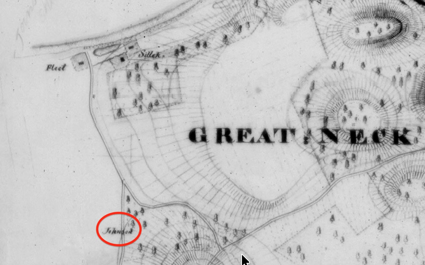
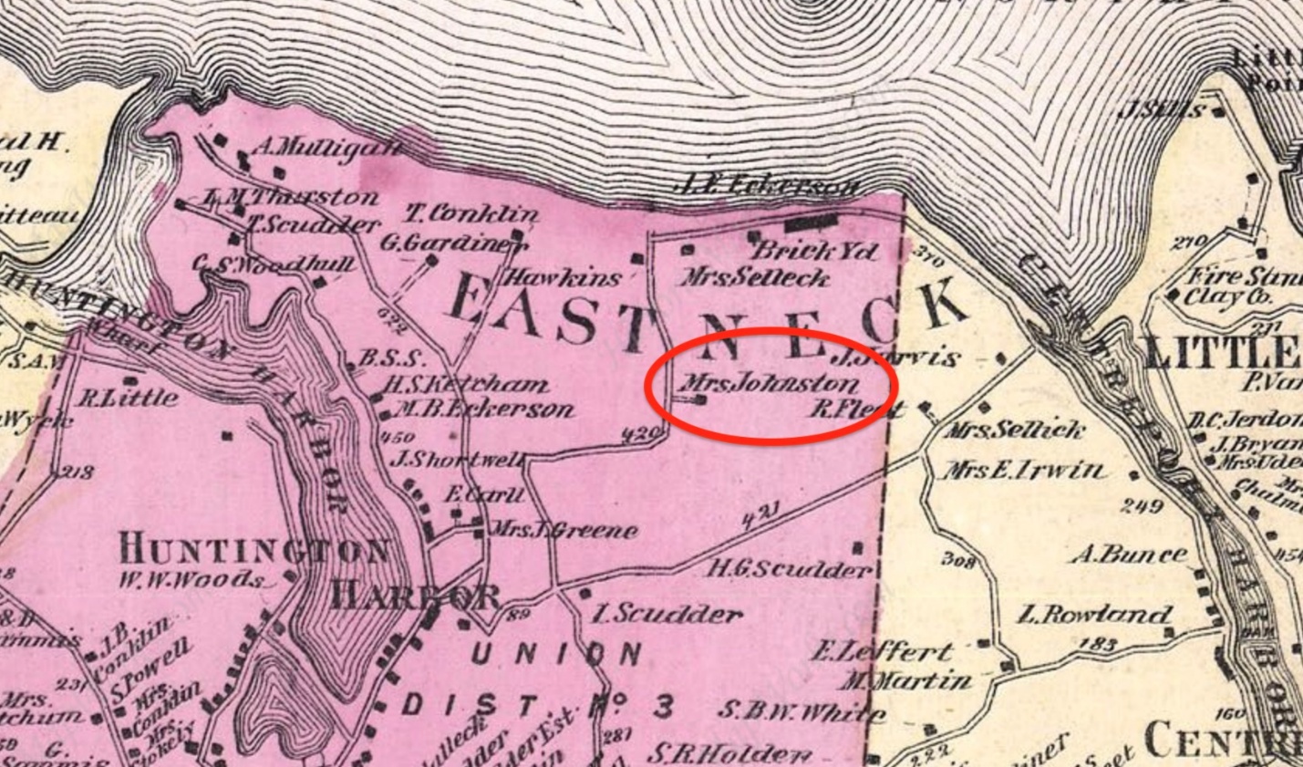
Nineteenth century maps identify Johnson as the owner of the Bay Road house. This is consistent with the 1877 deed by which William S. Johnson (grandson of the William Johnson who lived there a century earlier) sold the property. The deed describes the property as “commencing at the junction of the highway running northerly past the house of the said Samuel Johnson dec’d [father of the seller] to Huntington Bay [i.e. Bay Road] with the highway connecting the aforementioned highway with the highway called the Cove Road [i.e. Dale Road]” then running along Cove Road and back to Bay Road (Suffolk County Clerk’s Office Deed Liber 227, page 421). In other words, the Johnson property was at the southeast corner of Bay Road and Dale Road—the location where the Mother Chick’s marker was installed in 1977.
According to the Johnson family, the first man Hale saw in Huntington was William Johnson, who gave him food before he began his spying mission. When Hale set off, he instructed Johnson to watch for him on his return. When Hale came back, Johnson hid him in a stack of straw or stalks because it was not deemed safe for Hale to stay in the house. Hale became impatient and left the Johnson Farm and went to Mother Chick’s Inn, which was close to the beach and would provide a better vantage point to see the boat he was expecting. He was captured the next morning.
As we commemorate the 250th anniversary of Hale’s mission and execution, this mistake has been corrected. The 1977 Mother Chick’s marker has been relocated to Sydney Road, near the entrance to Nathan Hale Beach and a new marker for the Johnson Farm has been installed at 124 Bay Road.
[1] Nathan Hale 1776 Biography and Memorials, by Henry Phelps Johnston (Yale University Press 1914), page 100
[2] Spies, Patriots and Traitors, American Intelligence in the Revolutionary War, by Kenneth A. Daigler (Georgetown University Press 2014), page 95
[3] Spies, Patriots and Traitors, American Intelligence in the Revolutionary War, by Kenneth A. Daigler (Georgetown University Press 2014), page 95
[4] Extract of letter to the Missouri Republican from Stephen Hempstead, copied into the L.I. Star April 2, 1827. Reprinted in Revolutionary Incidents of Suffolk and Kings Counties, by Henry Onderdonk, Jr. (1849), page 49
[5] Washington’s Spies, The Story of America’s First Spy Ring, by Alexander Rose (Bantam Books 2014), page 27
[6] Letter from Ida Johnson to Cornelia Prime dated June 26, 1894, printed in The Long-Islander, June 30, 1894, page 5
[7] Huntington Town Records, Vol. III, page 17, footnote
[8] Nathan hale 1776, Biography and Memorials, by Henry Phelps Johnston (1914), page 119
[9] The Long-Islander, January 29, 1926, page 17
[10] Brooklyn Eagle, March 25, 1927, page 22
[11] The Long-Islander, May 13, 1938
[12] The Long-Islander, January 10, 1936, page 6, section two
[13] Robert Rogers, Ranger, The Rise and Fall of an American Icon, by Martin Klotz (Westholme Publishing 2024), page 220
[14] Maryland Historical magazine, Nol. 28 (1933) page 10; also Documentary Life of Nathan Hale, by George Dudley Seymour (1941), page 446.
[15] The Long-Islander, May 18, 1939, page 2
[16] Robert Rogers of the Rangers, by John R. Cuneo (Oxford University Press 1959; reprinted Fort Ticonderoga Museum 1988), page 270)
[17] Public Papers of George Clinton, Vol. VI, page 263, footnote
[18] The American Colonies and The Revolution [c. 1600-1795], by Consider Tiffany, Edited and Annotated by J. Calvitt Clarke III, Jacksonville University (https://www.academia.edu/40188172)
[19] Spies, Patriots, and Traitors: American Intelligence in the Revolutionary War, by Kenneth A, Daigler (Georgetown University Press 2014), page 106
[20]Washington’s Spies, The Story of America’s First Spy Ring, by Alexander Rose (Bantam Books 2014), page 29-30
[21] Huntington Town Records, Vol. II, page 377
[22] Seymour, Documentary Life of Nathan Hale, page 442.
[23] Huntington Town Records, Vol. II, page 243, footnote
[24] Rose, page 28-29
[25] Revolutionary Incidents of Suffolk and Queens Counties, by Henry Onderdonk (1849), pages 52-53
[26] Rose, Washington’s Spies, page 290-291
The Enduring Mystery of Nathan Hale,
America’s First Spy
Nathan Hale can be considered many things: a hero, a martyr, a failed spy. But mostly Nathan Hale is a mystery.
We know a fair amount of Hale other than the last two weeks of his life. He was born in Coventry, Connecticut in 1755. He graduated from Yale College in 1773 and then became a schoolteacher in Connecticut. After the Battle of Lexington and Concord in April 1775, he joined the Connecticut Militia and was soon elected lieutenant. He was at the siege of Boston.
The British left Boston on March 17, 1776 and Hale followed George Washington to New York, the anticipated next scene of conflict with British forces. That conflict came a few months later with the largest battle of the war. The American forces lost the Battle of Long Island but miraculously escaped to Manhattan. After the defeat, George Washington needed intelligence about British activities on Long Island and their plans to attack Manhattan.
As early as September 1, he asked his generals to find someone to gather intelligence of British activities on Long Island. He urged them “to establish ‘a channel of information’ through which frequent reports from the Long Island side could reach him.”
“Perhaps,” he wrote, “some might be got who are really Tories for a reasonable reward to undertake it. Those who are friends would be preferable, if they could manage it as well.”[1]
At the same time, Washington organized a Rangers unit under the command of Thomas Knowlton, who was tasked to recruit men to conduct tactical reconnaissance for the army.[2] Hale was recruited as a captain of one of the four companies in the unit.
Although the exact date is not known, sometime in the second week of September, Hale answered Washington’s call to gather intelligence on the British. What transpired over the next two weeks is a mystery. Much has been written over the past 250 years concerning Hale, much of it is speculation for there is scant direct contemporaneous evidence on which to rely.
His friends thought Hale was too naïve to be a good spy and tried to talk him out of proceeding. “From an intelligence perspective, he was a lousy spy. His selection, training (or lack thereof), and how he conducted his mission were horrible by both intelligence and commonsense standards.”[3]
The man who accompanied him from New York to start his journey provides details about the beginning of the mission. Sargent Stephen Hempstead shared these details in 1827 when he was 69 years old. He had served in Hale’s company of the Connecticut Militia. According to Hempstead, Hale told him that he was asked “to go over to L.I. to discover the disposition of the Enemy’s camp, &c., expecting them to attack N.Y.”[4] Sharing such details was not an auspicious start for a secret spying mission.
Hempstead says they left the American camp in Harlem Heights and made their way to Norwalk, which was the first place they could find a ship to ferry Hale across the Sound to Long Island. Hale left his belongings with Hempstead, except for his Yale diploma, and said he would pretend to be a Dutch school teacher looking for a position. It doesn’t make sense that he would pretend to be Dutch, especially since he would be travelling through the west end of Long Island, which still had a sizeable Dutch population. I.W. Stuart, who wrote an account of Nathan Hale’s mission in 1856, suggests that Hale was joking when he said he would be a Dutch schoolteacher. How would he explain that he had the diploma of a man with a very English name? But if he were a Connecticut schoolteacher looking for a school, carrying his Yale diploma as proof of his qualifications makes sense.
Captain Pond took Hale and Hempstead across the Sound on the Schuyler. They landed at Huntington Bay. That was the last time Hempstead saw Hale. Hempstead returned to Norwalk to await Hale’s return or word from Hale. (Alexander Rose, without citing a source, writes that a Tory informant in Norwalk noticed “the arrival of two men, both army types, only one of whom departed quietly in the night with the sloop while the other, Sergeant Hempstead, headed westwards back toward American lines.”[5] This is inconsistent with Hempstead’s first-hand account.)
According to Ida Johnson, writing in 1894, once on shore in Huntington, the first man Hale met was her great grandfather William Johnson, who lived in a house that still stands at 124 Bay Road. Johnson gave Hale some food and then Hale set off, telling Johnson that he “should watch for him on his return.”[6]
What Hale then did, where he went, what he discovered are unknown. We do know that he was captured a few days later and that at 11:00 on the morning on Sunday, September 22, Hale was hanged in Manhattan, near Third Avenue and 66th Street.
Where and how he was captured have been in dispute for the past two centuries.
According to the version widely believed in Huntington and set forth by Charles R. Street in his annotation of the Huntington Town Records (1889), Hale
made his way to Brooklyn, and having acquired the information desired, returned to Huntington; remained over night at the home of a friend, William Johnson, on East Neck. The next day he ventured down to a public inn kept by “Mother Chid,” (Chichester) at a place called “The Cedars,” at the head of Huntington Bay, near where Titus Conklin now lives, intending to cross to Connecticut in a boat. Seeing a boat approach he took it for the one expected, but he was mistaken, as it came from a British vessel and was manned by British sailors. His true character was revealed by a Loyalist at the inn and he was taken prisoner, hastened to the City of New York, and hung as a spy.[7]
British Troops had arrived in Huntington two weeks before Hale. So as soon as he arrived, he was in enemy territory.
But this “official” version began to be questioned. In 1918, Augustine Scudder, principal of the Lincoln School in Huntington Station, read a paper to the Huntington Historical Society arguing that Hale was not captured in Huntington. She relied on Henry Phelps Johnston’s 1914 biography of Hale. Johnston argued that Hale could not have been captured in Huntington because British General Howe’s Orderly Book for September 22 states “A spy from the enemy (by his own full confession) apprehended last night, was this day executed at 11 o’clock in front of the Artillery Park.” Johnston points out that if Hale was “apprehended” the night of September 21, there would not have been enough time to bring him from Huntington to Manhattan the same night, which was presumed to have been done by the H.M.S. Halifax, a 16-gun British warship. Moreover, Johnston asserts that the log for the Halifax indicated that the ship was not in Huntington at the time and that the log “in which every incident appears to be noticed, makes no mention of anything so creditable to her crew as the capture of a spy.”[8]
Romanah Sammis, president of the Historical Society and later Town Historian, agreed that Hale was not captured here.[9] Scudder and Sammis argued that Hale would have followed the British army into Manhattan after they landed there on September 15. Then being only a mile or so from the American forces in Harlem, it would have made no sense for him to return to Huntington. By the time he walked back to Huntington, was ferried by boat to Connecticut and walked back to the American camp in Harlem, it would be too late for his intelligence to have been of any use to Washington. Indeed, one could argue the whole enterprise, even if successful, was too lengthy to have been of much use by the time he would have returned to camp. Then again, the siege of Boston began on April 19, 1775 and the British did not attack the American forces until June 17, when they successfully captured Bunker Hill, but at the cost of a thousand casualties.
Sammis continued to argue that Hale was not captured in Huntington, suggesting in 1927 that the Nathan Hale memorial on Main Street should be removed.[10] She said the memorial was “a ‘miserably unsightly thing’ that was given to Huntington because it was left over on some job.”[11]
Sammis convinced the Town Board in 1935 to appoint a committee to study the matter.[12] The committee was greatly assisted by the work of Town Counsel Isaac Swezey and Walter Funnell, who had been appointed to the committee but resigned because he was living in Westchester at the time. While the committee released its report in 1939, Swezey and Funnell continued their research and corresponded with each other about this matter until their deaths in the 1950s.
The question of where Hale was captured depends on how he was captured. If he was captured because he mistook a British boat for an American boat, his place of capture must have been in Huntington because that is where he was expecting there to be a ship to take him back to Connecticut.
However, another version of Hale’s capture credits Robert Rogers of the Queen’s American Rangers with capturing Hale. Rogers was a hero of the French and Indian War who was commissioned by British commander William Howe to recruit a battalion of Loyalists. After the Battle of Long Island, Rogers’ Rangers were deployed to the north shore of Long Island to recruit members.[13] The Huntington committee discovered a diary kept by Captain William Bamford, a soldier in the British army. The diary did not come to light until 1933. Bamford’s entry for September 22, 1776 reads “Nathan Hales, a Capt in ye Rebel Army & a spy was taken by Majr Rogers & this mg hang’d he had several Papers wt accts of our Forces &ca he confess’d many deserters come in. he was a spy.”[14]
The reference to Rogers as Hale’s captor led the committee to review of the logs of the Halifax. The logs show that Rogers and his Rangers were aboard the ship in the period from September 16 to 21, the same period Hale was conducting his mission.
After reviewing the evidence at their disposal, the committee concluded that “it is manifestly impossible to prove absolutely that Nathan was captured at Huntington.” However, from the facts uncovered by the committee “the probability of capture at Huntington would appear to be much increased.” Therefore, with respect to changing the wording on local monuments, “it is the opinion of the Committee that the memorials were erected in good faith, that the tradition they embody is now strongly supported, and that it is not needful to disturb those memorials at present.”[15]
The most prominent biographer of Robert Rogers, writing in 1959, mentions the capture of Nathan Hale only briefly, relying on Bamford’s diary to connect Rogers to the capture. He posits that “Rogers’ connection with the incident is merely that he was halted while en route to Howe’s headquarters in his sloop and asked to bring Hale in.”[16] But an eighteenth-century manuscript that first came to light in 2000 when it was donated to the Library of Congress describes a much larger role for Rogers. Consider Tiffany was a Connecticut merchant who remained loyal to the crown. He wrote an account of the Revolution, either during or shortly after the war. According to Tiffany’s account, Hale was sent to Long Island “to find whether the Long Island inhabitants were friends to America or not.” This is a different mission than that described by Hale’s companion, Sargent Hempstead, who said Hale was sent to Long Island, “to discover the disposition of the Enemy’s camp, &c., expecting them to attack N.Y.” Likewise, Benjamin Talmadge, Hale’s Yale classmate and friend, recounting his interaction with Major John Andre after the British officer was captured, wrote that “After the British troops had entered N. York, Genl Washington wanted information respecting the strength, position & probable movements of the Enemy. Capt. Hale tendered his services, went into N. York, & was taken just as he was passing the out posts of the Enemy.”[17]
Beyond the difference in the description of Hale’s mission, Tiffany gives a completely new account of the circumstances of Hale’s capture and with a level of detail that seems unlikely for a shopkeeper in Connecticut to have known:
Colonel Rogers having for some days observed Capt. Hale, having for some [days] suspected that he was an enemy in disguise. And to convince himself, Rogers thought of trying the same method. He quickly altered his own habit with which he made Capt. Hale a visit at his quarters where the colonel fell into some discourse concerning the war, intimating the trouble of his mind in his being detained on an island where the inhabitants sided with Britons against the American colonies. Intimating withal that he himself was upon the business of spying out the inclination of the people and [the] motion of the British troops. This intrigue, not being suspected by the Capt. made him believe he had found a good friend and one that could be trusted with a secrecy of the business he was engaged in. And after the colonel’s drinking a health to the Congress informs Rogers of the business and intent.
The colonel, finding out the truth of the matter, invited Capt. Hale to dine with him the next day at his quarters unto which he agreed. The time being come, Capt. Hale repaired to the place agreed on where he met his pretended friend with three or four men of the same stamp and, after being refreshed, began the same conversation as hath been already mentioned. But in the height of their conversation, a company of soldiers surrounded the house and by orders from the commander seized Capt. Hale, in an instant. But he, denying his name and the business he came upon, was ordered to New York. But before he was carried far, several persons knew him and called him by name. Upon this, he was hanged as a spy, some say, without being brought before a court-martial.[18]
It is interesting to note that based on this account, two later writers differ on which meal Hale and Rogers shared when they met for the second time. Kenneth Daigler writes that they met for breakfast;[19] whereas Alexander Rose writes that they met in the afternoon and Rogers ordered ales for the group.[20]
One would hope that a review of the ship’s log for the Halifax would help to settle the question. But the log is difficult to decipher due to the handwriting, the use of abbreviations, and a lack of punctuation. Confusion may also have been caused by readers not appreciating that the log was recorded using a nautical day—that is a day that starts at noon the day before the date given. In other words, an entry for September 17 would start at noon on September 16 and end at noon on the 17th.
The Halifax log records that on the night of September 16, the Halifax “rec’d by sloop Conl. Rogers and a Party of Rangers.” At 4:00 a.m. on the 17th, the ship was in Huntington Bay to look for “two Rebel Privateers having Intelligence of them.” This most probably refers to the Schuyler, which is believed to have dropped Hale off early on the 16th. The second ship is believed to be the Montgomery, whose captain, William Rogers, was from Huntington. The search was unsuccessful.
On the 18th, a tender from the Halifax captured a Patriot schooner that was transporting four cases of gunpowder. The powder was taken and the schooner sunk. That same day there is a reference to “Sanseys point.” The evening of the 18th, the Halifax was off Oyster Bay near Centre Island. At 3:00 on the afternoon of the 19th, the ship was near Hempstead Bay. Later that night, “the Party of Rangers landed on Sanseys p.” This has been interpreted over the years as referring to Sands Point, located on the west side of Hempstead Bay and 16 miles west of Huntington Bay. However, historian Claire Bellerjeau discovered that the peninsula that Huntington residents think of as Wincoma Point is officially known as Sandy Point. That is the name given on the 1946 Official Highway map for the Town of Huntington and on the Town’s Geographic Information System map and in eighteenth century Huntington Town Records.[21] The peninsula is also called Sandy Point in newspaper articles and reports of the Chief of Engineers, U.S. Army.
The Huntington location is also supported by the account given by Stephen Hempstead, who had accompanied Hale at the start of his mission. Hempstead thought Hale was captured in Manhattan “at a tavern at a place called the ‘Cedars.’” But as noted by Seymour in his book, “There is no such geographic point revealed in all the exhaustive research which has been devoted to the famous island.”[22] But the shores of Huntington Bay, where Mother Chick’s Tavern was located, was known as the Cedars.[23] As with many of the accounts of Hale’s mission, Hempstead may have mixed up some details.
But the Halifax was off Hempstead Bay at 3:00 p.m. on the 19th. Could it have sailed east to Huntington Bay to drop off the Rangers? Wherever the ship was at 10:00 that night it weighed anchor and arrived at Whitestone Point at 4:00 a.m., six hours later. Whitestone Point is about 8 miles from Sands Point and about 26 miles from Huntington Bay. An 8 miles sail should not take six hours, but a 26 miles sail could.
At Whitestone Point, the Halifax was in company with the Niger, a British ship that spent the month of September at Whitestone. The log for the Niger reports that at 7:00 p.m. on the 19th it was “hailed from the North Shore.” A boat was sent and “returned with a Rebel Officer, a Deserter from their Army.” On the morning of the 20th, the Niger’s log records that the Halifax was anchored nearby, having come from the eastward. The next words in the Niger’s log are “Sent the Rebel officer to Head Quarters.” Could this have been Nathan Hale? It seems unlikely because this Rebel officer was taken to the Niger on the night of the 19th from the “North Shore,” which may refer to the north shore of the Sound, not the north shore of the Island. In any event, the Halifax log reports that on the 22nd—the day Hale was hanged—“Col. Rogers and his party of Rangers came from Flushing.”
The timeline above does not leave enough time to support Tiffany’s account.
As mentioned above, Swezey and Funnell continued their research long after the Huntington committee issued its report in 1939. After their deaths in the 1950s, their research papers were donated to the Huntington Historical Society, where they apparently sat unread for the next 70 years. But with the 250th anniversary of Hale’s execution in 2026, Toby Kissam read through the files and realized a theory supporting Huntington as the place of Hale’s capture could be developed.
Swezey secured letters from descendants of William Ludlam of Centre Island and William Johnson of Huntington Bay as well as a secondhand account from a woman whose ancestors had lived in the house in Newtown (now Elmhurst) that Howe had used as his headquarter for the first two weeks of September.
According to these testimonies, William Johnson helped Hale at the start of his mission. How would Hale have known to trust Johnson? Perhaps he was advised by William Rogers, the captain of the second privateer that accompanied the Schuyler, that he should look for Johnson’s house after he landed on the beach. Johnson’s descendants claim that their ancestor ferried Hale across Huntington Bay, through Lloyd Harbor and over the beach to Cold Spring Harbor then over to Centre Island. There Hale was able to borrow a horse from William Ludlam. Hale then set off on his mission—wherever that would have taken him. Swezey secured a letter from a Ludlam descendant to report that Hale returned the horse a few days later and returned to Huntington Bay to wait for the Schuyler to retrieve him.
In his book on the Culper Spy Ring, Alexander Rose contends that Rogers, “guessing that Hale would head west along the coastal road toward the city, planned to lie in wait to intercept him.”[24] But Rogers isn’t the only one guessing; Rose is also guessing. There appears to be no primary source for the proposition that Rogers followed Hale as he traveled west of the “coastal road” (presumably North Hempstead Turnpike, Route 25A). If Hale’s destination was Brooklyn, a better, less hilly route would have been by way of what is now Jericho Turnpike. It is perhaps more likely that Rogers guessed that Hale would return to the place he had started his mission, Huntington Bay. Therefore, Rogers could have decided to land at Sandy Point, Huntington and wait for Hale to return.
Whether one credits Tiffany’s account of Rogers trickery or the mistaken boat version, Hale would have been taken to Manhattan to be hanged. A likely route would have been by water to Flushing Bay, which is near Newtown, where Howe had had his headquarters until September 15. Swezey was told by a woman who lived to the house that was formerly Howe’s headquarters that she had been told by an 85-year-old woman, whose parents or grandparents had previously owned the house that Hale was kept in the basement of the house. Then on the 21st, he could have been transported over to Newtown Creek and from there taken by boat down the creek and across the East River to Howe’s new headquarters in Manhattan, where he was summarily sentenced to death. Rogers and his Rangers then returned to the Halifax by way of Flushing on the 22nd.
The truth may never be known with certainty but, as pointed out by the 1935 committee, Huntington appears to be the only locality with a tradition as being the place of Hale’s capture. Huntington as the place of capture is also supported by testimony from Robert Townsend and other Oyster Bay residents.[25]
Famous Last Words
The reason Hale is remembered is not because he was a valuable spy, but because of the final words attributed to him: “I only regret that I have but one life to lose for my country.”
In recent years, it has become popular to note that there is no proof that Hale ever said those words. That is true, but the legend persists. The famous last words are probably the work of Hale’s friend Captain William Hull and were most likely inspired by a line in a 1712 play by Joseph Addison called Cato, A Tragedy. In Act 4, Scene 4, Cato says, of the death of his son, “How beautiful is death when earned by virtue. Who would not be that youth? What pity is it that we can die but once to serve our country.”
Whether the line inspired Hale or Hull is the question. The first report of Hale’s last words appeared in the Essex Journal (Massachusetts) of February 13, 1777, which states that: “At the gallows, he [Hale] made a sensible and spirited speech; among other things, told them they were shedding the blood of the innocent, and that if he had ten thousand lives, he would lay them all down, if called to it, in defence of his injured, bleeding Country.”
Four years later, the Boston Independent Chronicle reported that Hale’s last words were “I am so satisfied with the cause in which I have engaged, that my only regret is, that I have not more lives than one to offer in its service.” By 1799 in Hannah Adams’ Summary History of New England, the statement came closer to the famous version, “he only lamented, that he had but one life to lose for his country.” [26]
* * *
Marker Mix-up
Confusion about whether Nathan Hale was captured at Mother Chick’s in Huntington or elsewhere extends to where exactly Mother Chick’s was.
In 1977, during the celebration of the Bicentennial, a historic marker was placed on Bay Road just south of Dale Road. The marker identifies this as the location of Mother Chick’s Inn. Unfortunately, the marker was in the wrong place. In 1776, the house at that location, which still stands, was the home of William Johnson, not Mother Chick. Mother Chick’s Inn was located near where Nathan Hale Beach Club is today. The mix up of the two buildings dates back to the early twentieth century, when post cards of the Johnson Farm identified the house as Mother Chick’s.
Nineteenth century maps identify Johnson as the owner of the Bay Road house. This is consistent with the 1877 deed by which William S. Johnson (grandson of the William Johnson who lived there a century earlier) sold the property. The deed describes the property as “commencing at the junction of the highway running northerly past the house of the said Samuel Johnson dec’d [father of the seller] to Huntington Bay [i.e. Bay Road] with the highway connecting the aforementioned highway with the highway called the Cove Road [i.e. Dale Road]” then running along Cove Road and back to Bay Road (Suffolk County Clerk’s Office Deed Liber 227, page 421). In other words, the Johnson property was at the southeast corner of Bay Road and Dale Road—the location where the Mother Chick’s marker was installed in 1977.
According to the Johnson family, the first man Hale saw in Huntington was William Johnson, who gave him food before he began his spying mission. When Hale set off, he instructed Johnson to watch for him on his return. When Hale came back, Johnson hid him in a stack of straw or stalks because it was not deemed safe for Hale to stay in the house. Hale became impatient and left the Johnson Farm and went to Mother Chick’s Inn, which was close to the beach and would provide a better vantage point to see the boat he was expecting. He was captured the next morning.
As we commemorate the 250th anniversary of Hale’s mission and execution, this mistake has been corrected. The 1977 Mother Chick’s marker has been relocated to Sydney Road, near the entrance to Nathan Hale Beach and a new marker for the Johnson Farm has been installed at 124 Bay Road.
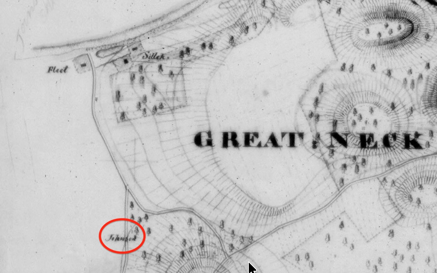
1837 Coastal Survey
[1] Nathan Hale 1776 Biography and Memorials, by Henry Phelps Johnston (Yale University Press 1914), page 100
[2] Spies, Patriots and Traitors, American Intelligence in the Revolutionary War, by Kenneth A. Daigler (Georgetown University Press 2014), page 95
[3] Spies, Patriots and Traitors, American Intelligence in the Revolutionary War, by Kenneth A. Daigler (Georgetown University Press 2014), page 95
[4] Extract of letter to the Missouri Republican from Stephen Hempstead, copied into the L.I. Star April 2, 1827. Reprinted in Revolutionary Incidents of Suffolk and Kings Counties, by Henry Onderdonk, Jr. (1849), page 49
[5] Washington’s Spies, The Story of America’s First Spy Ring, by Alexander Rose (Bantam Books 2014), page 27
[6] Letter from Ida Johnson to Cornelia Prime dated June 26, 1894, printed in The Long-Islander, June 30, 1894, page 5
[7] Huntington Town Records, Vol. III, page 17, footnote
[8] Nathan hale 1776, Biography and Memorials, by Henry Phelps Johnston (1914), page 119
[9] The Long-Islander, January 29, 1926, page 17
[10] Brooklyn Eagle, March 25, 1927, page 22
[11] The Long-Islander, May 13, 1938
[12] The Long-Islander, January 10, 1936, page 6, section two
[13] Robert Rogers, Ranger, The Rise and Fall of an American Icon, by Martin Klotz (Westholme Publishing 2024), page 220
[14] Maryland Historical magazine, Nol. 28 (1933) page 10; also Documentary Life of Nathan Hale, by George Dudley Seymour (1941), page 446.
[15] The Long-Islander, May 18, 1939, page 2
[16] Robert Rogers of the Rangers, by John R. Cuneo (Oxford University Press 1959; reprinted Fort Ticonderoga Museum 1988), page 270)
[17] Public Papers of George Clinton, Vol. VI, page 263, footnote
[18] The American Colonies and The Revolution [c. 1600-1795], by Consider Tiffany, Edited and Annotated by J. Calvitt Clarke III, Jacksonville University (https://www.academia.edu/40188172)
[19] Spies, Patriots, and Traitors: American Intelligence in the Revolutionary War, by Kenneth A, Daigler (Georgetown University Press 2014), page 106
[20]Washington’s Spies, The Story of America’s First Spy Ring, by Alexander Rose (Bantam Books 2014), page 29-30
[21] Huntington Town Records, Vol. II, page 377
[22] Seymour, Documentary Life of Nathan Hale, page 442.
[23] Huntington Town Records, Vol. II, page 243, footnote
[24] Rose, page 28-29
[25] Revolutionary Incidents of Suffolk and Queens Counties, by Henry Onderdonk (1849), pages 52-53
[26] Rose, Washington’s Spies, page 290-291